Kushiro night lights from space
Night Light of Kushiro (Hokkaido) from space (Japan) Src. Average luminocity for 10x10km area is 47.773% and for 50x50km: 3.9029%.
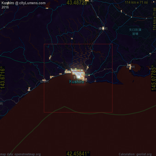
Analysis of Kushiro night lights 2016
Square area 10x10 km:
 10.32%
90-99
12.38%80-89
7.14%70-79
7.62%60-69
5.87%50-59
2.38%40-49
1.9%30-39
1.59%20-29
13.81%10-19
23.17%0-9
13.81%Square area 50x50 km:
0.45%90-99
0.67%80-89
0.61%70-79
0.61%60-69
0.5%50-59
0.41%40-49
0.24%30-39
0.21%20-29
1.38%10-19
3.3%0-9
91.63%Clear (daylight) street map image can be seen on geolist.org.
Map coordinates:
43° 29' 14.2" North, 143° 40' 17.8" East
42° 58' 30" North, 144° 22' 29" East
42° 27' 30.3" North, 145° 4' 40.3" East
Some cities around Kushiro sort by population:
• Obihiro
95.5 km =59.3 mi,  266°
266°
• Kitami
100 km =62.1 mi,  336°
336°
• Abashiri
116.6 km =72.5 mi,  355°
355°
• Otofuke
95.5 km =59.3 mi, 271°
• Nemuro
104.8 km =65.1 mi,  68°
68°
• Motomachi
97.3 km =60.5 mi,  346°
346°
• Shibetsu
97.7 km =60.7 mi,  38°
38°
• Kamikawa
161.3 km =100.2 mi,  306°
306°
2129376 (p: 183,612)
Sources (retrieved 2019-11-25):
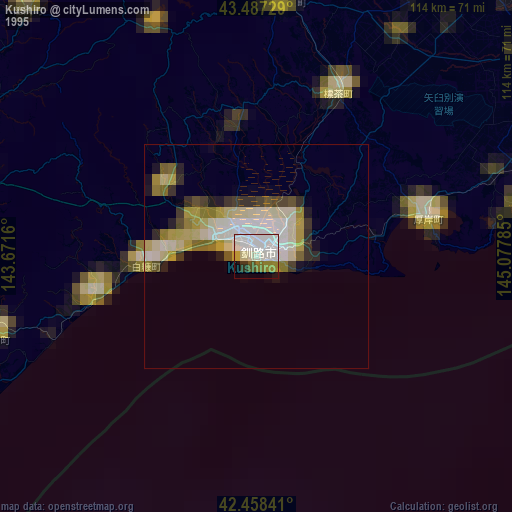
» NASA, Earths city lights 1995
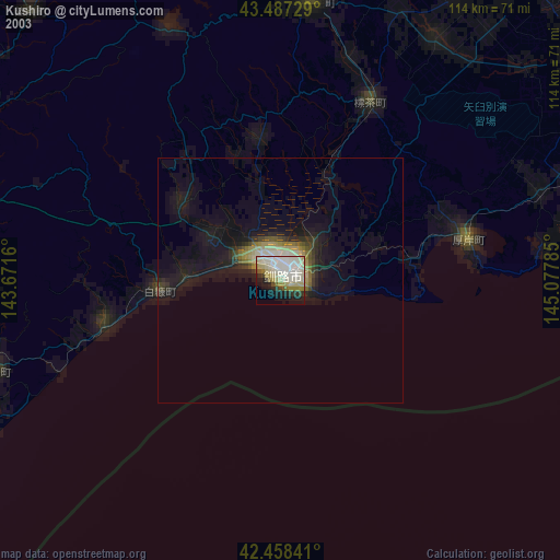
» NASA city lights 2003
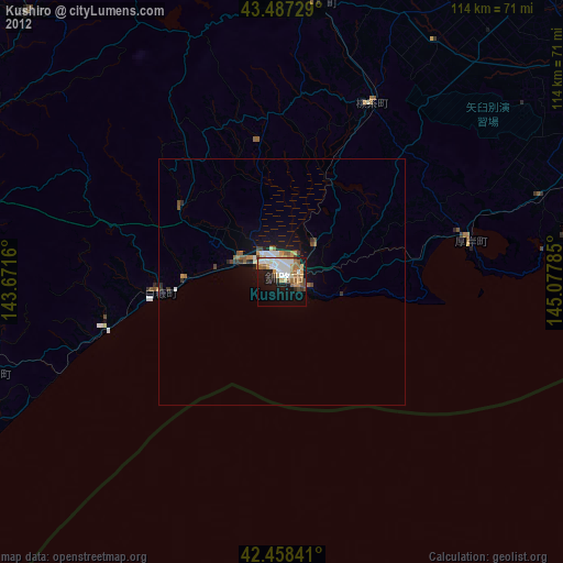
» Earth at Night: Flat Maps 2012, 2016