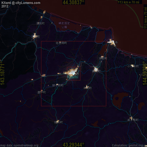
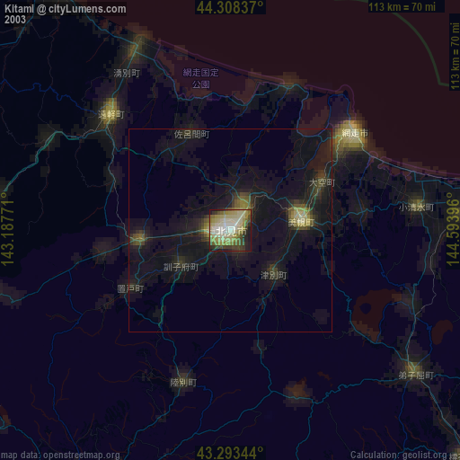
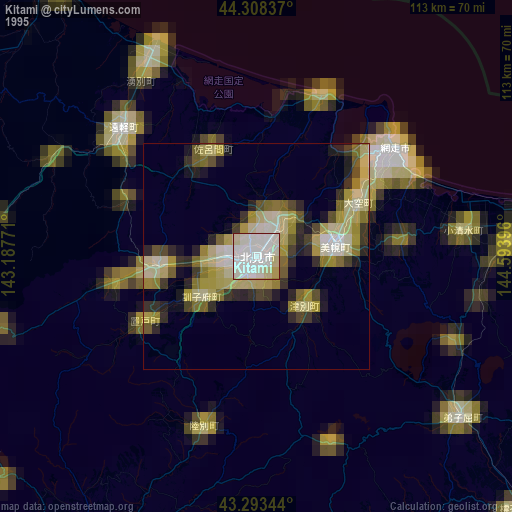
Kitami night lights from space
Night Light of Kitami (Hokkaido) from space (Japan) Src. Average luminocity for 10x10km area is 39.4561% and for 50x50km: 3.2948%.
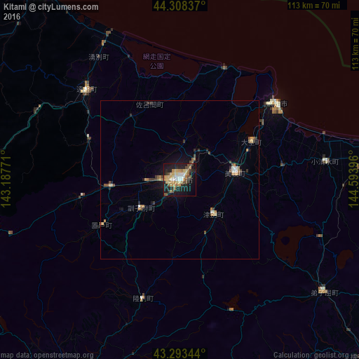
Analysis of Kitami night lights 2016
Square area 10x10 km:
 3.48%
3.48%90-99
5%80-89
8.18%70-79
9.85%60-69
5.61%50-59
4.85%40-49
4.24%30-39
2.58%20-29
10.15%10-19
33.79%0-9
12.27%Square area 50x50 km:
0.2%90-99
0.37%80-89
0.44%70-79
0.67%60-69
0.47%50-59
0.54%40-49
0.41%30-39
0.48%20-29
0.61%10-19
2.27%0-9
93.53%Clear (daylight) street map image can be seen on geolist.org.
Map coordinates:
44° 18' 30.1" North, 143° 11' 15.8" East
43° 48' 11" North, 143° 53' 27" East
43° 17' 36.4" North, 144° 35' 38.3" East
Some cities around Kitami sort by population:
• Kushiro
100 km =62.1 mi,  156°
156°
• Obihiro
113 km =70.2 mi,  209°
209°
• Abashiri
38.9 km =24.2 mi,  51°
51°
• Otofuke
106.1 km =65.9 mi, 211°
• Mombetsu
74.7 km =46.4 mi,  324°
324°
• Motomachi
16.7 km =10.4 mi,  81°
81°
• Shibetsu
101 km =62.8 mi,  99°
99°
• Kamikawa
89.9 km =55.9 mi,  272°
272°
2129537 (p: 113,137)
Sources (retrieved 2019-11-25):
» NASA, Earths city lights 1995
» NASA city lights 2003
» Earth at Night: Flat Maps 2012, 2016