Kamikawa night lights from space
Night Light of Kamikawa (Hokkaido) from space (Japan) Src. Average luminocity for 10x10km area is 1.4349% and for 50x50km: 0.6108%.
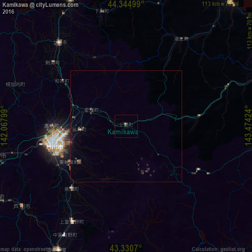
Analysis of Kamikawa night lights 2016
Square area 10x10 km:
 0%
0%90-99
0%80-89
0.63%70-79
0%60-69
0%50-59
0%40-49
1.27%30-39
0%20-29
0.63%10-19
0.63%0-9
96.83%Square area 50x50 km:
0%90-99
0%80-89
0.02%70-79
0%60-69
0.09%50-59
0.09%40-49
0.22%30-39
0.22%20-29
0.33%10-19
0.6%0-9
98.4%Clear (daylight) street map image can be seen on geolist.org.
Map coordinates:
44° 20' 42" North, 142° 4' 4.8" East
43° 50' 24" North, 142° 46' 16" East
43° 19' 50.5" North, 143° 28' 27.3" East
Some cities around Kamikawa sort by population:
• Asahikawa
33.5 km =20.8 mi,  256°
256°
• Mombetsu
73.5 km =45.7 mi,  39°
39°
• Nayoro
62 km =38.5 mi,  336°
336°
• Fukagawa
60.6 km =37.7 mi, 255°
• Shimo-furano
62.8 km =39 mi,  209°
209°
• Ashibetsu
59.7 km =37.1 mi,  232°
232°
• Akabira
66 km =41 mi,  240°
240°
• Utashinai
68.2 km =42.4 mi, 238°
2129761 (p: 5,294)
Sources (retrieved 2019-11-25):
» Earth at Night: Flat Maps 2012, 2016