Kure night lights from space
Night Light of Kure (Hiroshima) from space (Japan) Src. Average luminocity for 10x10km area is 34.3242% and for 50x50km: 14.9349%.
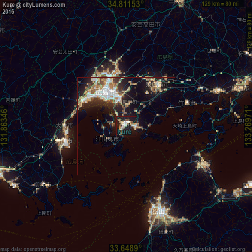
Analysis of Kure night lights 2016
Square area 10x10 km:
 5.31%
5.31%90-99
6.23%80-89
3.66%70-79
2.56%60-69
5.86%50-59
4.21%40-49
4.21%30-39
1.47%20-29
5.68%10-19
50.55%0-9
10.26%Square area 50x50 km:
2.27%90-99
2.57%80-89
1.96%70-79
1.68%60-69
2.24%50-59
1.99%40-49
1.51%30-39
2.29%20-29
4.25%10-19
10.04%0-9
69.19%Clear (daylight) street map image can be seen on geolist.org.
Map coordinates:
34° 48' 41.5" North, 131° 51' 48.5" East
34° 13' 56" North, 132° 33' 59.7" East
33° 38' 56" North, 133° 16' 11" East
Some cities around Kure sort by population:
• Hiroshima
21.5 km =13.4 mi,  330°
330°
• Matsuyama
47.4 km =29.5 mi,  157°
157°
• Iwakuni
32.8 km =20.4 mi,  256°
256°
• Hatsukaichi
25.1 km =15.6 mi,  301°
301°
• Takehara
34.3 km =21.3 mi,  69°
69°
• Ōtake
31.9 km =19.8 mi,  265°
265°
• Hōjō
34.4 km =21.4 mi,  145°
145°
• Ōno-hara
28.1 km =17.5 mi,  281°
281°
1858296 (p: 196,624)
Sources (retrieved 2019-11-25):
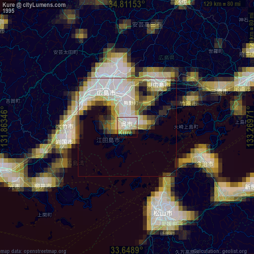
» NASA, Earths city lights 1995
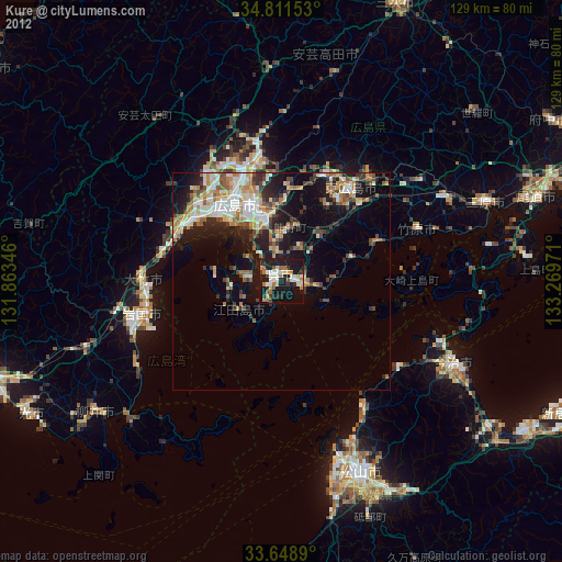
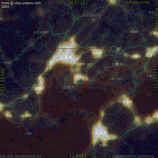
» NASA city lights 2003
» Earth at Night: Flat Maps 2012, 2016