Iwakuni night lights from space
Night Light of Iwakuni (Yamaguchi) from space (Japan) Src. Average luminocity for 10x10km area is 39.5989% and for 50x50km: 7.5367%.

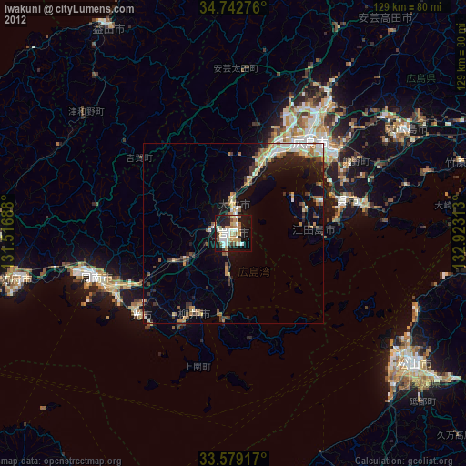
Analysis of Iwakuni night lights 2016
Square area 10x10 km:
 3.85%
3.85%90-99
8.79%80-89
5.49%70-79
3.11%60-69
5.68%50-59
10.44%40-49
3.3%30-39
4.21%20-29
10.62%10-19
38.64%0-9
5.86%Square area 50x50 km:
1.02%90-99
1.32%80-89
0.89%70-79
0.63%60-69
0.82%50-59
1.42%40-49
0.75%30-39
0.98%20-29
2.3%10-19
5.13%0-9
84.73%Clear (daylight) street map image can be seen on geolist.org.
Map coordinates:
34° 44' 33.9" North, 131° 31' 0.8" East
34° 9' 46.7" North, 132° 13' 12" East
33° 34' 45" North, 132° 55' 23.3" East
Some cities around Iwakuni sort by population:
• Hiroshima
33.8 km =21 mi,  38°
38°
• Kure
32.8 km =20.4 mi,  76°
76°
• Hatsukaichi
23.3 km =14.5 mi,  26°
26°
• Kudamatsu
37.2 km =23.1 mi,  240°
240°
• Hikari
34 km =21.1 mi,  227°
227°
• Yanai
23.8 km =14.8 mi,  203°
203°
• Ōtake
5 km =3.1 mi,  0°
0°
• Ōno-hara
14.1 km =8.8 mi,  17°
17°
1861212 (p: 104,004)
Sources (retrieved 2019-11-25):
» NASA, Earths city lights 1995
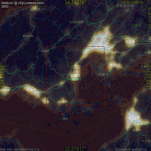
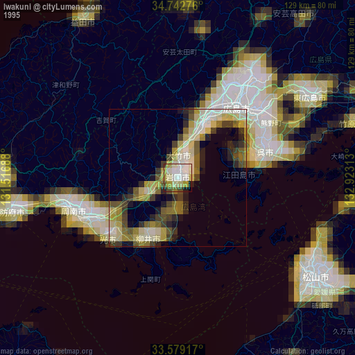
» NASA city lights 2003
» Earth at Night: Flat Maps 2012, 2016