Hatsukaichi night lights from space
Night Light of Hatsukaichi (Hiroshima) from space (Japan) Src. Average luminocity for 10x10km area is 44.7381% and for 50x50km: 17.1151%.
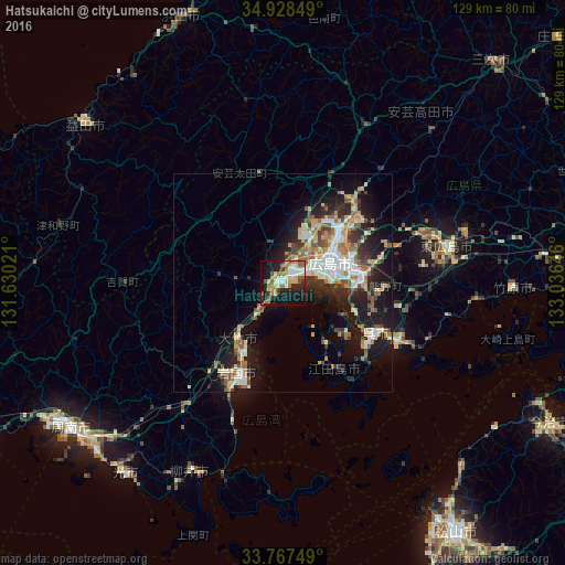
Analysis of Hatsukaichi night lights 2016
Square area 10x10 km:
 4.58%
4.58%90-99
9.52%80-89
9.34%70-79
4.4%60-69
6.59%50-59
10.26%40-49
1.47%30-39
3.48%20-29
14.65%10-19
30.95%0-9
4.76%Square area 50x50 km:
2.48%90-99
3.04%80-89
2.31%70-79
1.81%60-69
2.51%50-59
2.78%40-49
1.54%30-39
2.34%20-29
4.98%10-19
11.98%0-9
64.21%Clear (daylight) street map image can be seen on geolist.org.
Map coordinates:
34° 55' 42.6" North, 131° 37' 48.8" East
34° 21' 0" North, 132° 19' 60" East
33° 46' 3" North, 133° 2' 11.3" East
Some cities around Hatsukaichi sort by population:
• Hiroshima
12.1 km =7.5 mi,  62°
62°
• Kure
25.1 km =15.6 mi,  121°
121°
• Iwakuni
23.3 km =14.5 mi,  206°
206°
• Hikari
56.3 km =35 mi,  218°
218°
• Yanai
47.1 km =29.3 mi, 205°
• Takehara
53.6 km =33.3 mi,  91°
91°
• Ōtake
18.9 km =11.7 mi, 213°
• Ōno-hara
9.6 km =6 mi, 219°
1863018 (p: 77,341)
Sources (retrieved 2019-11-25):
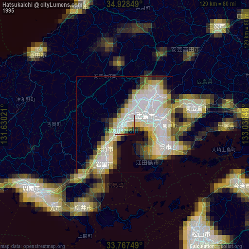
» NASA, Earths city lights 1995
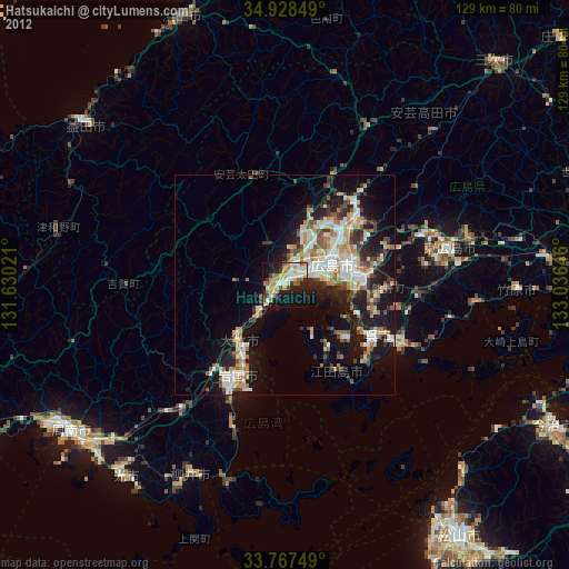
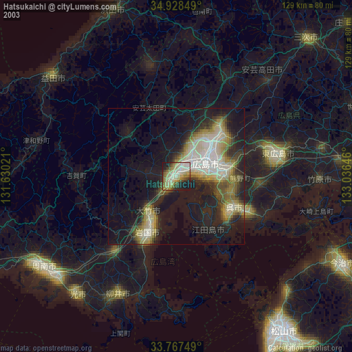
» NASA city lights 2003
» Earth at Night: Flat Maps 2012, 2016