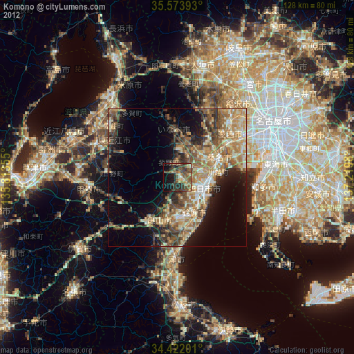
Komono night lights from space
Night Light of Komono (Mie) from space (Japan) Src. Average luminocity for 10x10km area is 26.285% and for 50x50km: 23.0568%.
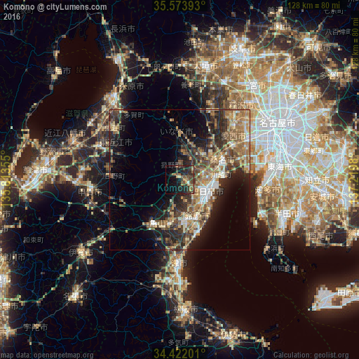
Analysis of Komono night lights 2016
Square area 10x10 km:
100  0.52%
0.52%
90-99 0.17%
80-89 2.1%
70-79 4.37%
60-69 4.37%
50-59 6.12%
40-49 10.49%
30-39 8.04%
20-29 13.64%
10-19 17.13%
0-9 33.04%
0.52%90-99
0.17%80-89
2.1%70-79
4.37%60-69
4.37%50-59
6.12%40-49
10.49%30-39
8.04%20-29
13.64%10-19
17.13%0-9
33.04%Square area 50x50 km:
100 1.87%
90-99 2.73%
80-89 3.03%
70-79 3.29%
60-69 4.73%
50-59 5.11%
40-49 4.69%
30-39 4.76%
20-29 7.46%
10-19 9.48%
0-9 52.85%
1.87%90-99
2.73%80-89
3.03%70-79
3.29%60-69
4.73%50-59
5.11%40-49
4.69%30-39
4.76%20-29
7.46%10-19
9.48%0-9
52.85%Clear (daylight) street map image can be seen on geolist.org.
Map coordinates:
35° 34' 26.1" North, 135° 48' 48.8" East
35° 0' 0" North, 136° 31' 0" East
34° 25' 19.2" North, 137° 13' 11.3" East
Some cities around Komono sort by population:
• Yokkaichi
9.8 km =6.1 mi,  112°
112°
• Suzuka
14.3 km =8.9 mi,  154°
154°
• Kuwana
15.1 km =9.4 mi,  67°
67°
• Tsushima
26 km =16.2 mi,  44°
44°
• Kameyama
17.8 km =11.1 mi,  200°
200°
• Kanie
29.7 km =18.5 mi,  60°
60°
• Hino
24.3 km =15.1 mi,  270°
270°
• Kawage
21.9 km =13.6 mi,  172°
172°
1858866 (p: 40,740)
Sources (retrieved 2019-11-25):
» Earth at Night: Flat Maps 2012, 2016