Kanie night lights from space
Night Light of Kanie (Aichi) from space (Japan) Src. Average luminocity for 10x10km area is 84.035% and for 50x50km: 64.2237%.
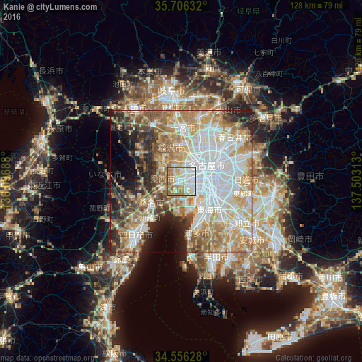

Analysis of Kanie night lights 2016
Square area 10x10 km:
100  23.08%
90-99 29.72%
80-89 9.27%
70-79 9.27%
60-69 19.23%
50-59 9.44%
40-49 0%
30-39 0%
20-29 0%
10-19 0%
0-9 0%
23.08%90-99
29.72%80-89
9.27%70-79
9.27%60-69
19.23%50-59
9.44%40-49
0%30-39
0%20-29
0%10-19
0%0-9
0%Square area 50x50 km:
100 17.87%
90-99 14.3%
80-89 8.45%
70-79 9.53%
60-69 10.98%
50-59 8.09%
40-49 5.2%
30-39 4.61%
20-29 7.2%
10-19 6.26%
0-9 7.53%
17.87%90-99
14.3%80-89
8.45%70-79
9.53%60-69
10.98%50-59
8.09%40-49
5.2%30-39
4.61%20-29
7.2%10-19
6.26%0-9
7.53%Clear (daylight) street map image can be seen on geolist.org.
Map coordinates:
35° 42' 22.8" North, 136° 5' 48.8" East
35° 7' 60" North, 136° 48' 0" East
34° 33' 22.6" North, 137° 30' 11.3" East
Some cities around Kanie sort by population:
• Nagoya
11.1 km =6.9 mi,  61°
61°
• Ichinomiya
18.5 km =11.5 mi,  0°
0°
• Kuwana
14.9 km =9.3 mi,  232°
232°
• Inazawa
13.1 km =8.1 mi,  353°
353°
• Ōbu
18.7 km =11.6 mi,  133°
133°
• Tsushima
8.4 km =5.2 mi,  296°
296°
• Iwakura
17.7 km =11 mi,  19°
19°
• Sobue
15 km =9.3 mi,  329°
329°
1860191 (p: 36,592)
Sources (retrieved 2019-11-25):
» Earth at Night: Flat Maps 2012, 2016