Kaseda-shirakame night lights from space
Night Light of Kaseda-shirakame (Kagoshima) from space (Japan) Src. Average luminocity for 10x10km area is 2.0262% and for 50x50km: 5.274%.
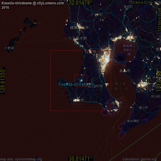
Analysis of Kaseda-shirakame night lights 2016
Square area 10x10 km:
 0%
0%90-99
0.7%80-89
0.17%70-79
0.52%60-69
0%50-59
0%40-49
0%30-39
0.17%20-29
1.92%10-19
0.7%0-9
95.8%Square area 50x50 km:
0.69%90-99
1.05%80-89
0.74%70-79
0.58%60-69
0.92%50-59
0.93%40-49
0.45%30-39
0.58%20-29
1.53%10-19
2.25%0-9
90.28%Clear (daylight) street map image can be seen on geolist.org.
Map coordinates:
32° 0' 53.2" North, 129° 36' 48.8" East
31° 25' 0" North, 130° 19' 0" East
30° 48' 53" North, 131° 1' 11.3" East
Some cities around Kaseda-shirakame sort by population:
• Kagoshima
27.7 km =17.2 mi,  52°
52°
• Satsumasendai
44.5 km =27.7 mi,  357°
357°
• Ibusuki
37.7 km =23.4 mi,  122°
122°
• Kushikino
33.7 km =20.9 mi,  351°
351°
• Ijūin
23.6 km =14.7 mi,  19°
19°
• Makurazaki
16.7 km =10.4 mi,  180°
180°
• Kajiki
48.4 km =30.1 mi,  43°
43°
• Tarumizu
37.1 km =23.1 mi,  78°
78°
1859964 (p: 23,710)
Sources (retrieved 2019-11-25):
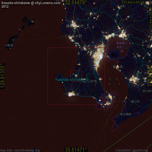
» Earth at Night: Flat Maps 2012, 2016