Iwase night lights from space
Night Light of Iwase (Ibaraki) from space (Japan) Src. Average luminocity for 10x10km area is 9.8024% and for 50x50km: 21.5609%.
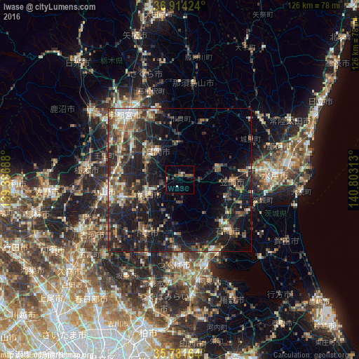
Analysis of Iwase night lights 2016
Square area 10x10 km:
100  0.17%
0.17%
90-99 1.92%
80-89 0%
70-79 0%
60-69 2.45%
50-59 2.45%
40-49 2.97%
30-39 1.05%
20-29 2.62%
10-19 0.7%
0-9 85.66%
0.17%90-99
1.92%80-89
0%70-79
0%60-69
2.45%50-59
2.45%40-49
2.97%30-39
1.05%20-29
2.62%10-19
0.7%0-9
85.66%Square area 50x50 km:
100 1.26%
90-99 2.88%
80-89 1.66%
70-79 2.34%
60-69 3.47%
50-59 4.24%
40-49 4.48%
30-39 5.42%
20-29 9.18%
10-19 20.2%
0-9 44.87%
1.26%90-99
2.88%80-89
1.66%70-79
2.34%60-69
3.47%50-59
4.24%40-49
4.48%30-39
5.42%20-29
9.18%10-19
20.2%0-9
44.87%Clear (daylight) street map image can be seen on geolist.org.
Map coordinates:
36° 54' 51.3" North, 139° 23' 48.8" East
36° 21' 0" North, 140° 6' 0" East
35° 46' 53.9" North, 140° 48' 11.3" East
Some cities around Iwase sort by population:
• Tsukuba
16.7 km =10.4 mi,  180°
180°
• Mooka
11.9 km =7.4 mi,  321°
321°
• Shimodate
11.8 km =7.3 mi,  241°
241°
• Tomobe
17.9 km =11.1 mi,  90°
90°
• Kaminokawa
18.8 km =11.7 mi,  299°
299°
• Kasama
15.4 km =9.6 mi,  76°
76°
• Mashiko
13 km =8.1 mi,  0°
0°
• Makabe
9.3 km =5.8 mi, 180°
2112521 (p: 21,980)
Sources (retrieved 2019-11-25):
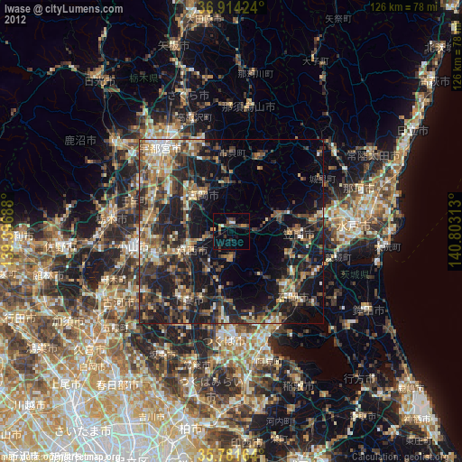
» Earth at Night: Flat Maps 2012, 2016