Higashine night lights from space
Night Light of Higashine (Yamagata) from space (Japan) Src. Average luminocity for 10x10km area is 24.711% and for 50x50km: 6.7511%.
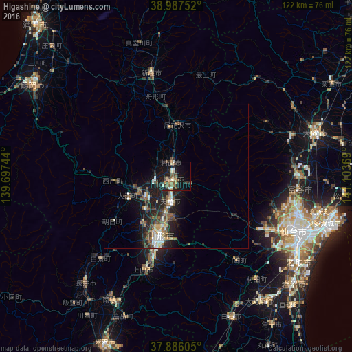
Analysis of Higashine night lights 2016
Square area 10x10 km:
 0.49%
0.49%90-99
4.22%80-89
3.41%70-79
1.62%60-69
2.76%50-59
6.82%40-49
5.03%30-39
3.73%20-29
8.44%10-19
27.44%0-9
36.04%Square area 50x50 km:
0.5%90-99
0.99%80-89
0.74%70-79
0.55%60-69
0.72%50-59
1.47%40-49
1.45%30-39
1.23%20-29
2.7%10-19
5.92%0-9
83.71%Clear (daylight) street map image can be seen on geolist.org.
Map coordinates:
38° 59' 15.1" North, 139° 41' 50.8" East
38° 26' 20" North, 140° 24' 2" East
37° 53' 9.8" North, 141° 6' 13.3" East
Some cities around Higashine sort by population:
• Sendai
44.9 km =27.9 mi,  115°
115°
• Yamagata
23 km =14.3 mi,  187°
187°
• Tendō
9.9 km =6.2 mi,  195°
195°
• Sagae
13.4 km =8.3 mi,  236°
236°
• Tomiya
42.6 km =26.5 mi,  96°
96°
• Shinjō
36.6 km =22.7 mi,  346°
346°
• Kaminoyama
33.6 km =20.9 mi, 199°
• Obanazawa
18.3 km =11.4 mi,  0°
0°
2112758 (p: 45,779)
Sources (retrieved 2019-11-25):
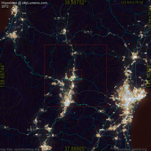
» Earth at Night: Flat Maps 2012, 2016