Tomiya night lights from space
Night Light of Tomiya (Miyagi) from space (Japan) Src. Average luminocity for 10x10km area is 34.8997% and for 50x50km: 19.4471%.
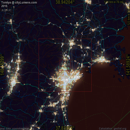
Analysis of Tomiya night lights 2016
Square area 10x10 km:
100  2.55%
2.55%
90-99 5.61%
80-89 1.53%
70-79 4.59%
60-69 6.8%
50-59 5.61%
40-49 3.23%
30-39 8.33%
20-29 21.77%
10-19 34.01%
0-9 5.95%
2.55%90-99
5.61%80-89
1.53%70-79
4.59%60-69
6.8%50-59
5.61%40-49
3.23%30-39
8.33%20-29
21.77%10-19
34.01%0-9
5.95%Square area 50x50 km:
100 3.24%
90-99 4.29%
80-89 2.09%
70-79 2.6%
60-69 3.2%
50-59 2.23%
40-49 1.79%
30-39 2.34%
20-29 4.67%
10-19 9.61%
0-9 63.94%
3.24%90-99
4.29%80-89
2.09%70-79
2.6%60-69
3.2%50-59
2.23%40-49
1.79%30-39
2.34%20-29
4.67%10-19
9.61%0-9
63.94%Clear (daylight) street map image can be seen on geolist.org.
Map coordinates:
38° 56' 31.3" North, 140° 10' 58.8" East
38° 23' 35" North, 140° 53' 10" East
37° 50' 23.6" North, 141° 35' 21.3" East
Some cities around Tomiya sort by population:
• Sendai
14.2 km =8.8 mi,  186°
186°
• Furukawa
20.8 km =12.9 mi,  16°
16°
• Shiogama
15.4 km =9.6 mi,  123°
123°
• Rifu
10.5 km =6.5 mi,  131°
131°
• Yamoto
28.9 km =18 mi,  82°
82°
• Kogota
22.5 km =14 mi,  39°
39°
• Wakuya
27.4 km =17 mi,  52°
52°
• Matsushima
15.4 km =9.6 mi,  98°
98°
2110744 (p: 42,500)
Sources (retrieved 2019-11-25):
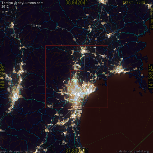
» Earth at Night: Flat Maps 2012, 2016