Al Quwayrah night lights from space
Night Light of Al Quwayrah (Ma’an) from space (Jordan) Src. Average luminocity for 10x10km area is 10.4762% and for 50x50km: 2.2994%.
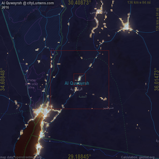
Analysis of Al Quwayrah night lights 2016
Square area 10x10 km:
 0.4%
0.4%90-99
0.79%80-89
2.38%70-79
2.78%60-69
0%50-59
0%40-49
3.77%30-39
2.38%20-29
1.98%10-19
0.6%0-9
84.92%Square area 50x50 km:
0.08%90-99
0.11%80-89
0.22%70-79
0.85%60-69
0.17%50-59
0.17%40-49
0.66%30-39
0.44%20-29
0.59%10-19
0.67%0-9
96.04%Clear (daylight) street map image can be seen on geolist.org.
Map coordinates:
30° 24' 31.4" North, 34° 36' 30.5" East
29° 48' 1.6" North, 35° 18' 41.8" East
29° 11' 18.4" North, 36° 0' 53" East
Some cities around Al Quwayrah sort by population:
• Aqaba
42.3 km =26.3 mi,  223°
223°
• Ma'an
59.9 km =37.2 mi,  42°
42°
• Eilat, IL
44.3 km =27.5 mi,  232°
232°
• Aţ Ţafīlah
118.7 km =73.8 mi,  13°
13°
• Safi
138.2 km =85.9 mi, 6°
• Petra
60.1 km =37.3 mi,  15°
15°
• Yeroẖam, IL
137 km =85.1 mi,  344°
344°
• Buşayrā
107.5 km =66.8 mi, 15°
250462 (p: 7,372)
Sources (retrieved 2019-11-25):
» Earth at Night: Flat Maps 2012, 2016