Montego Bay night lights from space
Night Light of Montego Bay (St. James) from space (Jamaica) Src. Average luminocity for 10x10km area is 64.5413% and for 50x50km: 8.6087%.
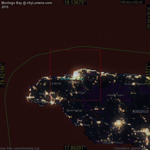
Analysis of Montego Bay night lights 2016
Square area 10x10 km:
 15.5%
15.5%90-99
16.94%80-89
18.18%70-79
5.99%60-69
2.89%50-59
2.89%40-49
5.79%30-39
2.27%20-29
17.77%10-19
10.74%0-9
1.03%Square area 50x50 km:
0.63%90-99
0.97%80-89
1.84%70-79
0.75%60-69
0.84%50-59
1.04%40-49
1.67%30-39
1.46%20-29
2.67%10-19
6.49%0-9
81.64%Clear (daylight) street map image can be seen on geolist.org.
Map coordinates:
19° 8' 12.3" North, 78° 37' 19.1" West
18° 28' 16.2" North, 77° 55' 7.8" West
17° 48' 10.7" North, 77° 12' 56.6" West
Some cities around Montego Bay sort by population:
• Mandeville
64.6 km =40.1 mi,  137°
137°
• Savanna-la-Mar
36 km =22.4 mi,  218°
218°
• Santa Cruz
52 km =32.3 mi,  153°
153°
• Falmouth
27.8 km =17.3 mi,  84°
84°
• Runaway Bay
61.5 km =38.2 mi,  91°
91°
• Lucea
27 km =16.8 mi,  265°
265°
• Porus
72.2 km =44.9 mi,  132°
132°
• Black River
50 km =31.1 mi,  171°
171°
3489460 (p: 82,867)
Sources (retrieved 2019-11-25):
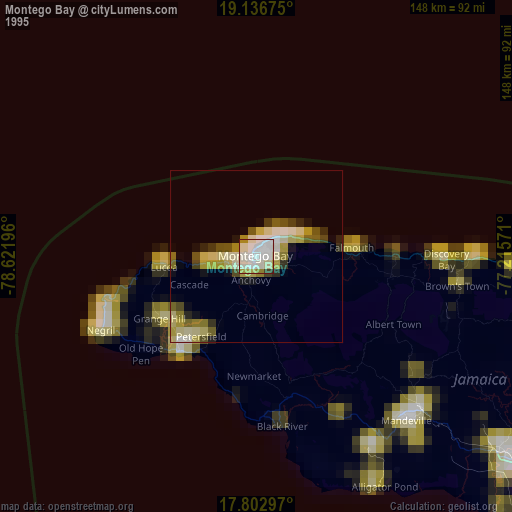
» NASA, Earths city lights 1995
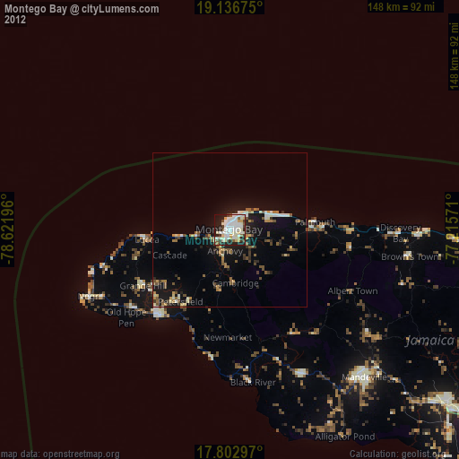
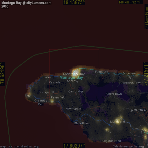
» NASA city lights 2003
» Earth at Night: Flat Maps 2012, 2016