Savanna-la-Mar night lights from space
Night Light of Savanna-la-Mar (Westmoreland) from space (Jamaica) Src. Average luminocity for 10x10km area is 28.3117% and for 50x50km: 7.7748%.
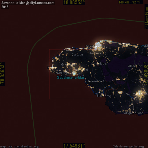
Analysis of Savanna-la-Mar night lights 2016
Square area 10x10 km:
 1.3%
1.3%90-99
3.68%80-89
8.23%70-79
2.6%60-69
5.19%50-59
2.38%40-49
1.95%30-39
3.25%20-29
6.71%10-19
33.33%0-9
31.39%Square area 50x50 km:
0.15%90-99
0.37%80-89
1.49%70-79
1.04%60-69
1.07%50-59
1.2%40-49
1.84%30-39
1.55%20-29
1.77%10-19
6.02%0-9
83.49%Clear (daylight) street map image can be seen on geolist.org.
Map coordinates:
18° 53' 7.9" North, 78° 50' 10.8" West
18° 13' 8.2" North, 78° 7' 59.5" West
17° 32' 59.3" North, 77° 25' 48.3" West
Some cities around Savanna-la-Mar sort by population:
• Montego Bay
36 km =22.4 mi,  38°
38°
• Mandeville
69 km =42.9 mi,  106°
106°
• Santa Cruz
49.5 km =30.8 mi, 111°
• Falmouth
58.9 km =36.6 mi,  58°
58°
• Bull Savanna
68.3 km =42.4 mi,  122°
122°
• Lucea
26.1 km =16.2 mi,  350°
350°
• Porus
78.9 km =49 mi,  104°
104°
• Black River
36.9 km =22.9 mi,  125°
125°
3488613 (p: 16,553)
Sources (retrieved 2019-11-25):
» Earth at Night: Flat Maps 2012, 2016