Lucea night lights from space
Night Light of Lucea (Hanover) from space (Jamaica) Src. Average luminocity for 10x10km area is 11.7025% and for 50x50km: 7.2366%.
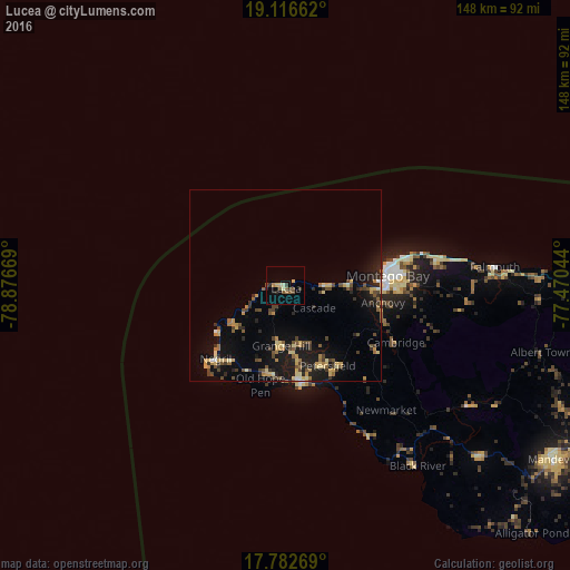
Analysis of Lucea night lights 2016
Square area 10x10 km:
 0%
0%90-99
1.24%80-89
2.48%70-79
0.62%60-69
1.45%50-59
3.1%40-49
2.69%30-39
2.48%20-29
1.45%10-19
1.03%0-9
83.47%Square area 50x50 km:
0.1%90-99
0.39%80-89
1.5%70-79
1.03%60-69
0.89%50-59
1.04%40-49
1.66%30-39
1.31%20-29
1.57%10-19
5.81%0-9
84.71%Clear (daylight) street map image can be seen on geolist.org.
Map coordinates:
19° 6' 59.8" North, 78° 52' 36.1" West
18° 27' 3.4" North, 78° 10' 24.8" West
17° 46' 57.7" North, 77° 28' 13.6" West
Some cities around Lucea sort by population:
• Montego Bay
27 km =16.8 mi,  85°
85°
• Mandeville
83.8 km =52.1 mi,  122°
122°
• Savanna-la-Mar
26.1 km =16.2 mi,  170°
170°
• Santa Cruz
66.9 km =41.6 mi,  131°
131°
• Falmouth
54.8 km =34.1 mi, 85°
• Bull Savanna
87.9 km =54.6 mi,  135°
135°
• Runaway Bay
88.4 km =54.9 mi, 89°
• Black River
58.4 km =36.3 mi, 143°
3489657 (p: 6,289)
Sources (retrieved 2019-11-25):
» Earth at Night: Flat Maps 2012, 2016