Verdellino night lights from space
Night Light of Verdellino (Lombardy) from space (Italy) Src. Average luminocity for 10x10km area is 80.803% and for 50x50km: 58.36%.
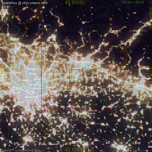
Analysis of Verdellino night lights 2016
Square area 10x10 km:
 21.67%
90-99
22.27%80-89
8.48%70-79
15.3%60-69
20.15%50-59
6.21%40-49
5.3%30-39
0.61%20-29
0%10-19
0%0-9
0%Square area 50x50 km:
13.38%90-99
14.3%80-89
5.71%70-79
6.9%60-69
8.53%50-59
8.21%40-49
7.46%30-39
8.75%20-29
12.49%10-19
11.9%0-9
2.37%Clear (daylight) street map image can be seen on geolist.org.
Map coordinates:
46° 5' 27.1" North, 8° 54' 17.7" East
45° 36' 3.9" North, 9° 36' 29" East
45° 6' 25.1" North, 10° 18' 40.2" East
Some cities around Verdellino sort by population:
• Dalmine
5.4 km =3.4 mi,  358°
358°
• Stezzano
6.4 km =4 mi,  32°
32°
• Osio Sotto
2.2 km =1.4 mi,  318°
318°
• Capriate San Gervasio
6.2 km =3.9 mi,  282°
282°
• Brembate
4.2 km =2.6 mi, 275°
• Ciserano
1.6 km =1 mi,  200°
200°
• Boltiere
2.3 km =1.4 mi,  269°
269°
• Spirano
5.2 km =3.2 mi,  114°
114°
6534524 (p: 7,641)
Sources (retrieved 2019-11-25):
» Earth at Night: Flat Maps 2012, 2016