Ciserano night lights from space
Night Light of Ciserano (Lombardy) from space (Italy) Src. Average luminocity for 10x10km area is 77.8803% and for 50x50km: 58.9419%.
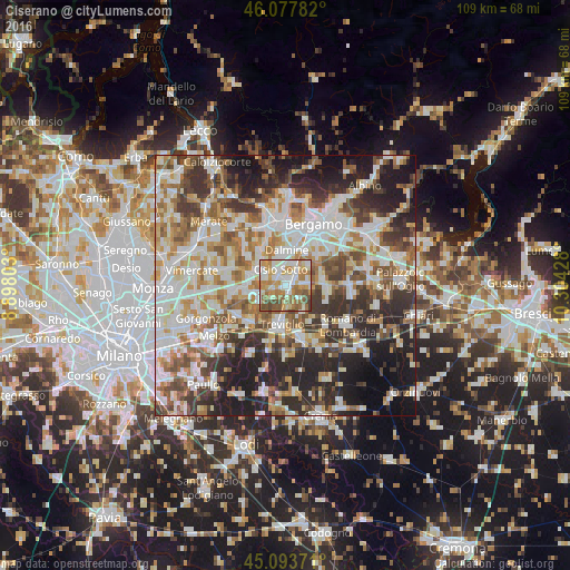
Analysis of Ciserano night lights 2016
Square area 10x10 km:
 17.88%
90-99
21.36%80-89
8.64%70-79
13.79%60-69
19.24%50-59
11.06%40-49
7.27%30-39
0.76%20-29
0%10-19
0%0-9
0%Square area 50x50 km:
13.61%90-99
14.53%80-89
5.83%70-79
6.94%60-69
8.68%50-59
8.25%40-49
7.35%30-39
8.65%20-29
12.56%10-19
11.37%0-9
2.23%Clear (daylight) street map image can be seen on geolist.org.
Map coordinates:
46° 4' 40.2" North, 8° 53' 52.9" East
45° 35' 16.5" North, 9° 36' 4.1" East
45° 5' 37.4" North, 10° 18' 15.4" East
Some cities around Ciserano sort by population:
• Osio Sotto
3.3 km =2.1 mi,  343°
343°
• Verdellino
1.6 km =1 mi,  20°
20°
• Verdello
2.8 km =1.7 mi,  50°
50°
• Fara Gera d'Adda
6.1 km =3.8 mi,  235°
235°
• Brembate
4.1 km =2.5 mi,  297°
297°
• Brignano Gera d'Adda
6 km =3.7 mi,  145°
145°
• Boltiere
2.3 km =1.4 mi,  309°
309°
• Spirano
5.3 km =3.3 mi,  97°
97°
3178642 (p: 5,666)
Sources (retrieved 2019-11-25):
» Earth at Night: Flat Maps 2012, 2016