Veggia-Villalunga night lights from space
Night Light of Veggia-Villalunga (Emilia-Romagna) from space (Italy) Src. Average luminocity for 10x10km area is 65.0909% and for 50x50km: 31.9002%.
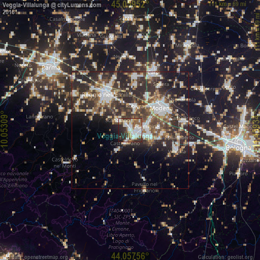
Analysis of Veggia-Villalunga night lights 2016
Square area 10x10 km:
 17.73%
90-99
18.79%80-89
5.91%70-79
3.03%60-69
7.27%50-59
11.97%40-49
6.97%30-39
8.94%20-29
15.45%10-19
3.94%0-9
0%Square area 50x50 km:
5.43%90-99
6.68%80-89
3.15%70-79
2.86%60-69
3.41%50-59
4.36%40-49
6.06%30-39
7.4%20-29
13.19%10-19
10.53%0-9
36.93%Clear (daylight) street map image can be seen on geolist.org.
Map coordinates:
45° 3' 34.3" North, 10° 3' 11.1" East
44° 33' 38.5" North, 10° 45' 22.4" East
44° 3' 27.2" North, 11° 27' 33.6" East
Some cities around Veggia-Villalunga sort by population:
• Sassuolo
3 km =1.9 mi,  130°
130°
• Formigine
7.3 km =4.5 mi,  79°
79°
• Fiorano
5 km =3.1 mi,  118°
118°
• Rubiera
10.3 km =6.4 mi,  10°
10°
• Scandiano
6.4 km =4 mi,  311°
311°
• Castellarano
5 km =3.1 mi,  197°
197°
• Maranello
9.5 km =5.9 mi,  110°
110°
• Casalgrande
3.1 km =1.9 mi,  328°
328°
8948767 (p: 6,110)
Sources (retrieved 2019-11-25):
» Earth at Night: Flat Maps 2012, 2016