Sassuolo night lights from space
Night Light of Sassuolo (Emilia-Romagna) from space (Italy) Src. Average luminocity for 10x10km area is 68.3683% and for 50x50km: 30.145%.
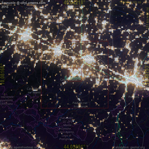
Analysis of Sassuolo night lights 2016
Square area 10x10 km:
 23.02%
90-99
21.27%80-89
4.92%70-79
2.22%60-69
7.46%50-59
6.51%40-49
6.51%30-39
9.52%20-29
17.3%10-19
1.27%0-9
0%Square area 50x50 km:
5.04%90-99
6.23%80-89
3%70-79
2.72%60-69
3.22%50-59
4.18%40-49
5.73%30-39
7.06%20-29
12%10-19
10.91%0-9
39.91%Clear (daylight) street map image can be seen on geolist.org.
Map coordinates:
45° 2' 31.8" North, 10° 4' 54" East
44° 32' 35.5" North, 10° 47' 5.3" East
44° 2' 23.7" North, 11° 29' 16.5" East
Some cities around Sassuolo sort by population:
• Formigine
5.9 km =3.7 mi,  56°
56°
• Fiorano
2.2 km =1.4 mi,  102°
102°
• Scandiano
9.4 km =5.8 mi,  310°
310°
• Castellarano
4.7 km =2.9 mi,  233°
233°
• Maranello
6.8 km =4.2 mi, 101°
• Castelnuovo Rangone
11.8 km =7.3 mi,  86°
86°
• Casalgrande
6 km =3.7 mi,  319°
319°
• Veggia-Villalunga
3 km =1.9 mi, 310°
3167053 (p: 36,926)
Sources (retrieved 2019-11-25):
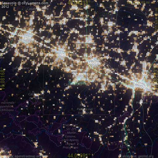
» Earth at Night: Flat Maps 2012, 2016