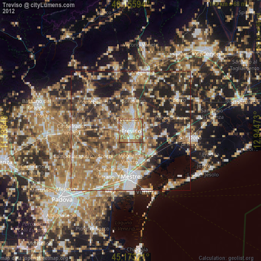
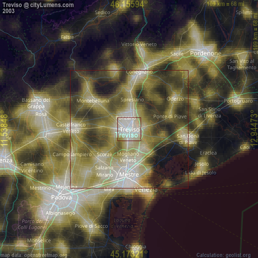
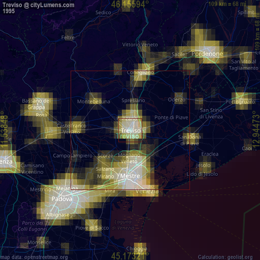
Treviso night lights from space
Night Light of Treviso (Veneto) from space (Italy) Src. Average luminocity for 10x10km area is 73.997% and for 50x50km: 46.1993%.
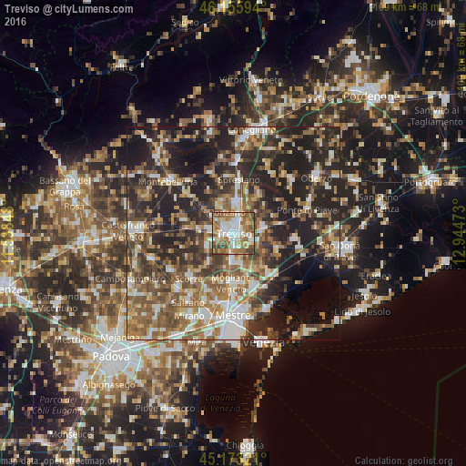
Analysis of Treviso night lights 2016
Square area 10x10 km:
 15.76%
90-99
18.18%80-89
9.39%70-79
8.33%60-69
17.42%50-59
17.58%40-49
9.55%30-39
3.79%20-29
0%10-19
0%0-9
0%Square area 50x50 km:
6.06%90-99
8.33%80-89
4.45%70-79
5.44%60-69
8.09%50-59
10.02%40-49
9.05%30-39
8.18%20-29
16.75%10-19
16.84%0-9
6.79%Clear (daylight) street map image can be seen on geolist.org.
Map coordinates:
46° 9' 21.4" North, 11° 32' 18.5" East
45° 40' 0.2" North, 12° 14' 29.8" East
45° 10' 23.6" North, 12° 56' 41" East
Some cities around Treviso sort by population:
• Lancenigo-Villorba
5.3 km =3.3 mi,  13°
13°
• Ponzano
6.1 km =3.8 mi,  331°
331°
• Paese
6.1 km =3.8 mi,  277°
277°
• Quinto di Treviso
6.5 km =4 mi,  246°
246°
• Preganziol
7.3 km =4.5 mi,  182°
182°
• Silea
4.5 km =2.8 mi,  107°
107°
• Frescada
4.2 km =2.6 mi,  185°
185°
• Dosson
3.5 km =2.2 mi,  164°
164°
3165201 (p: 77,604)
Sources (retrieved 2019-11-25):
» NASA, Earths city lights 1995
» NASA city lights 2003
» Earth at Night: Flat Maps 2012, 2016