Sorbolo night lights from space
Night Light of Sorbolo (Emilia-Romagna) from space (Italy) Src. Average luminocity for 10x10km area is 29.1111% and for 50x50km: 33.7691%.
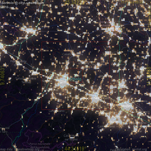
Analysis of Sorbolo night lights 2016
Square area 10x10 km:
 1.59%
1.59%90-99
3.49%80-89
2.38%70-79
4.6%60-69
1.75%50-59
1.43%40-49
2.06%30-39
6.51%20-29
23.33%10-19
52.86%0-9
0%Square area 50x50 km:
4.89%90-99
6.55%80-89
2.91%70-79
3.19%60-69
3.71%50-59
4.14%40-49
4.57%30-39
7.05%20-29
15.3%10-19
28.06%0-9
19.64%Clear (daylight) street map image can be seen on geolist.org.
Map coordinates:
45° 20' 32" North, 9° 44' 26.3" East
44° 50' 45.1" North, 10° 26' 37.5" East
44° 20' 42.7" North, 11° 8' 48.8" East
Some cities around Sorbolo sort by population:
• Parma
10.6 km =6.6 mi,  240°
240°
• Viadana
11.6 km =7.2 mi,  30°
30°
• Casalmaggiore
16.1 km =10 mi,  353°
353°
• Sant'Ilario d'Enza
9.7 km =6 mi,  178°
178°
• Castelnovo di Sotto
10.4 km =6.5 mi,  110°
110°
• Colorno
10.5 km =6.5 mi,  328°
328°
• Cadelbosco di Sopra
15.1 km =9.4 mi,  126°
126°
• Boretto
10.5 km =6.5 mi,  53°
53°
3166374 (p: 7,137)
Sources (retrieved 2019-11-25):
» Earth at Night: Flat Maps 2012, 2016