Boretto night lights from space
Night Light of Boretto (Emilia-Romagna) from space (Italy) Src. Average luminocity for 10x10km area is 35.3667% and for 50x50km: 34.4073%.
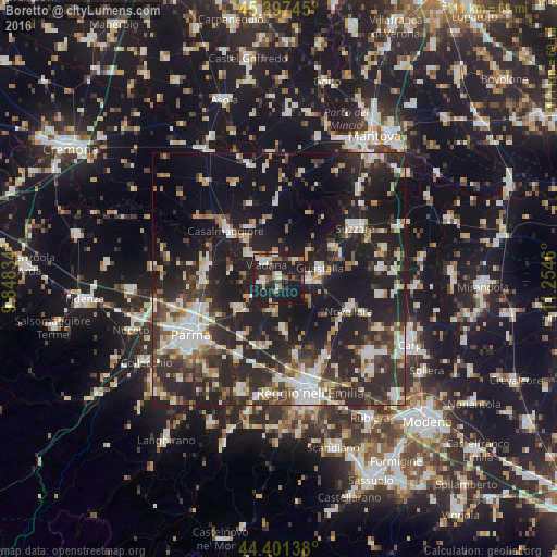
Analysis of Boretto night lights 2016
Square area 10x10 km:
 4.76%
4.76%90-99
7.78%80-89
1.59%70-79
2.22%60-69
5.4%50-59
4.92%40-49
3.33%30-39
2.86%20-29
17.3%10-19
49.68%0-9
0.16%Square area 50x50 km:
5.04%90-99
7.04%80-89
3.03%70-79
2.99%60-69
3.42%50-59
3.98%40-49
4.99%30-39
6.27%20-29
16.14%10-19
29.63%0-9
17.47%Clear (daylight) street map image can be seen on geolist.org.
Map coordinates:
45° 23' 50.8" North, 9° 50' 54" East
44° 54' 5.7" North, 10° 33' 5.3" East
44° 24' 5" North, 11° 15' 16.6" East
Some cities around Boretto sort by population:
• Viadana
4.6 km =2.9 mi,  325°
325°
• Guastalla
8.8 km =5.5 mi,  82°
82°
• Casalmaggiore
14.2 km =8.8 mi,  313°
313°
• Novellara
15.2 km =9.4 mi,  114°
114°
• Castelnovo di Sotto
10 km =6.2 mi,  172°
172°
• Sorbolo
10.5 km =6.5 mi,  233°
233°
• Colorno
14.3 km =8.9 mi,  280°
280°
• Cadelbosco di Sopra
15.6 km =9.7 mi, 166°
3181854 (p: 5,106)
Sources (retrieved 2019-11-25):
» Earth at Night: Flat Maps 2012, 2016