Parma night lights from space
Night Light of Parma (Emilia-Romagna) from space (Italy) Src. Average luminocity for 10x10km area is 82.7143% and for 50x50km: 30.4978%.
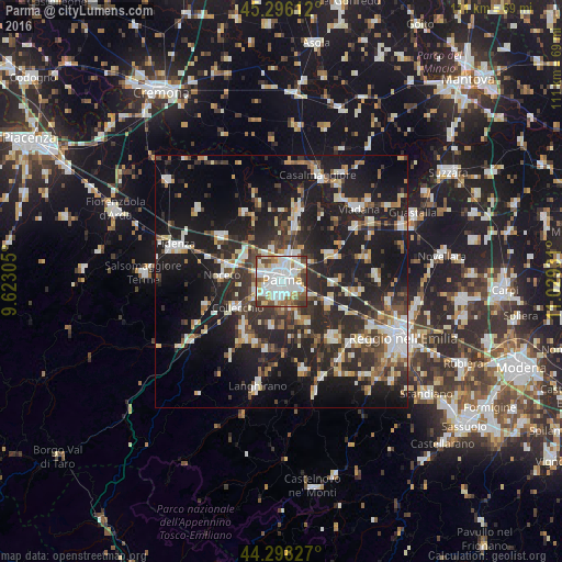
Analysis of Parma night lights 2016
Square area 10x10 km:
 28.57%
90-99
29.52%80-89
6.51%70-79
7.14%60-69
6.51%50-59
10%40-49
7.14%30-39
4.44%20-29
0.16%10-19
0%0-9
0%Square area 50x50 km:
4.47%90-99
6.09%80-89
2.74%70-79
2.88%60-69
3.28%50-59
3.48%40-49
3.91%30-39
5.86%20-29
12.75%10-19
25.79%0-9
28.76%Clear (daylight) street map image can be seen on geolist.org.
Map coordinates:
45° 17' 46" North, 9° 37' 23" East
44° 47' 57.7" North, 10° 19' 34.2" East
44° 17' 53.8" North, 11° 1' 45.5" East
Some cities around Parma sort by population:
• Montecchio Emilia
14.9 km =9.3 mi,  138°
138°
• Sant'Ilario d'Enza
10.6 km =6.6 mi,  115°
115°
• Noceto
11.8 km =7.3 mi,  275°
275°
• Collecchio
10.2 km =6.3 mi,  238°
238°
• Castelnovo di Sotto
19 km =11.8 mi,  85°
85°
• Sorbolo
10.6 km =6.6 mi,  60°
60°
• Colorno
14.5 km =9 mi,  14°
14°
• Traversetolo
18 km =11.2 mi,  166°
166°
3171457 (p: 146,299)
Sources (retrieved 2019-11-25):
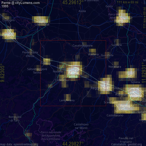
» NASA, Earths city lights 1995
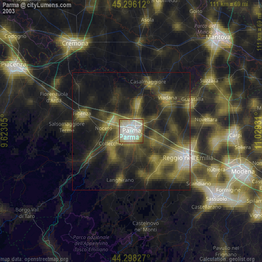
» NASA city lights 2003
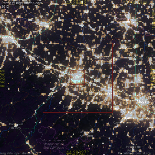
» Earth at Night: Flat Maps 2012, 2016