Solofra night lights from space
Night Light of Solofra (Campania) from space (Italy) Src. Average luminocity for 10x10km area is 39.466% and for 50x50km: 35.9699%.
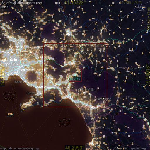
Analysis of Solofra night lights 2016
Square area 10x10 km:
 2.21%
2.21%90-99
5.95%80-89
7.99%70-79
3.74%60-69
3.74%50-59
5.95%40-49
5.44%30-39
12.59%20-29
25.51%10-19
17.52%0-9
9.35%Square area 50x50 km:
4.22%90-99
6.71%80-89
4.2%70-79
4.06%60-69
5.21%50-59
6.27%40-49
5.71%30-39
7.78%20-29
14.34%10-19
16.83%0-9
24.67%Clear (daylight) street map image can be seen on geolist.org.
Map coordinates:
41° 21' 47.8" North, 14° 8' 2.1" East
40° 50' 0.3" North, 14° 50' 13.4" East
40° 17' 57.5" North, 15° 32' 24.6" East
Some cities around Solofra sort by population:
• Avellino
9.9 km =6.2 mi,  336°
336°
• Baronissi
10.9 km =6.8 mi,  209°
209°
• Mercato San Severino
8.9 km =5.5 mi,  232°
232°
• Atripalda
9.5 km =5.9 mi,  355°
355°
• Montoro Superiore
3.7 km =2.3 mi,  240°
240°
• Serino
3.8 km =2.4 mi,  51°
51°
• Sala
3.9 km =2.4 mi, 51°
• Lancusi-Penta-Bolano
9.1 km =5.7 mi, 208°
3166420 (p: 11,886)
Sources (retrieved 2019-11-25):
» Earth at Night: Flat Maps 2012, 2016