Baronissi night lights from space
Night Light of Baronissi (Campania) from space (Italy) Src. Average luminocity for 10x10km area is 61.0244% and for 50x50km: 37.1785%.
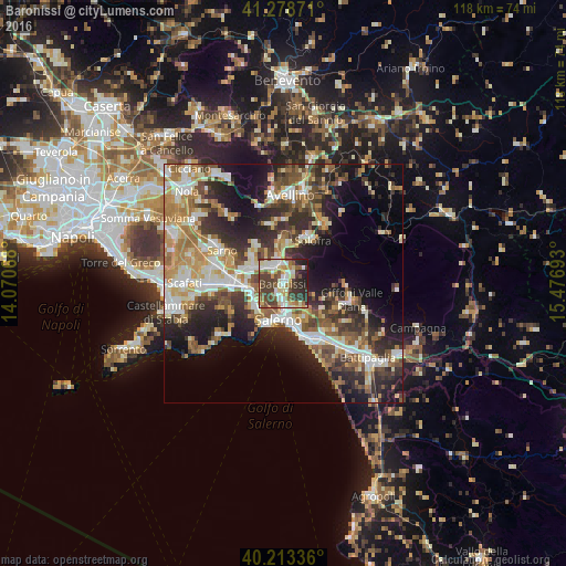
Analysis of Baronissi night lights 2016
Square area 10x10 km:
 9.58%
9.58%90-99
15.26%80-89
8.93%70-79
6.66%60-69
6.01%50-59
9.42%40-49
16.07%30-39
15.1%20-29
10.71%10-19
2.27%0-9
0%Square area 50x50 km:
5.35%90-99
7.69%80-89
4.35%70-79
5.06%60-69
6.23%50-59
5.78%40-49
5.23%30-39
6.81%20-29
10.63%10-19
12.73%0-9
30.14%Clear (daylight) street map image can be seen on geolist.org.
Map coordinates:
41° 16' 43.4" North, 14° 4' 14.4" East
40° 44' 53.4" North, 14° 46' 25.7" East
40° 12' 48.1" North, 15° 28' 36.9" East
Some cities around Baronissi sort by population:
• Salerno
8.3 km =5.2 mi,  168°
168°
• Cava Dè Tirreni
7.8 km =4.8 mi,  225°
225°
• Mercato San Severino
4.4 km =2.7 mi,  337°
337°
• Montoro Superiore
7.9 km =4.9 mi,  15°
15°
• Castel San Giorgio
7.2 km =4.5 mi,  301°
301°
• Roccapiemonte
7.1 km =4.4 mi,  280°
280°
• Lancusi-Penta-Bolano
1.7 km =1.1 mi,  33°
33°
• Piazza del Galdo-Sant'Angelo
5.6 km =3.5 mi, 300°
3182337 (p: 12,383)
Sources (retrieved 2019-11-25):
» Earth at Night: Flat Maps 2012, 2016