Avellino night lights from space
Night Light of Avellino (Campania) from space (Italy) Src. Average luminocity for 10x10km area is 58.7279% and for 50x50km: 37.9504%.
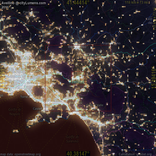
Analysis of Avellino night lights 2016
Square area 10x10 km:
 7.82%
7.82%90-99
10.54%80-89
6.63%70-79
7.31%60-69
6.29%50-59
21.6%40-49
17.52%30-39
9.86%20-29
11.22%10-19
1.19%0-9
0%Square area 50x50 km:
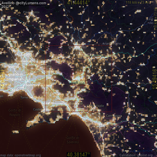
4.11%90-99
7.31%80-89
4.51%70-79
5.02%60-69
6.44%50-59
5.63%40-49
5.35%30-39
7.89%20-29
14.35%10-19
19.34%0-9
20.05%Clear (daylight) street map image can be seen on geolist.org.
Map coordinates:
41° 26' 38.9" North, 14° 5' 16.5" East
40° 54' 53.8" North, 14° 47' 27.7" East
40° 22' 53.3" North, 15° 29' 39" East
Some cities around Avellino sort by population:
• Solofra
9.9 km =6.2 mi,  156°
156°
• Monteforte Irpino
4.2 km =2.6 mi,  250°
250°
• Atripalda
3.1 km =1.9 mi,  82°
82°
• Montoro Superiore
10.9 km =6.8 mi,  176°
176°
• Mercogliano
3.9 km =2.4 mi,  280°
280°
• Serino
9.6 km =6 mi,  134°
134°
• Sala
9.6 km =6 mi, 133°
• Bracigliano
12.8 km =8 mi,  213°
213°
3182650 (p: 48,104)
Sources (retrieved 2019-11-25):
» Earth at Night: Flat Maps 2012, 2016