Atripalda night lights from space
Night Light of Atripalda (Campania) from space (Italy) Src. Average luminocity for 10x10km area is 55.3486% and for 50x50km: 34.9427%.
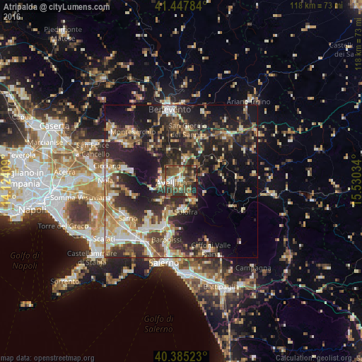
Analysis of Atripalda night lights 2016
Square area 10x10 km:
 5.78%
5.78%90-99
6.63%80-89
6.8%70-79
7.48%60-69
6.29%50-59
21.77%40-49
18.54%30-39
13.95%20-29
11.73%10-19
1.02%0-9
0%Square area 50x50 km:
3.49%90-99
6.48%80-89
4.02%70-79
4.16%60-69
5.59%50-59
5.65%40-49
5.32%30-39
7.62%20-29
14.14%10-19
20.07%0-9
23.48%Clear (daylight) street map image can be seen on geolist.org.
Map coordinates:
41° 26' 52.2" North, 14° 7' 26.7" East
40° 55' 7.2" North, 14° 49' 38" East
40° 23' 6.8" North, 15° 31' 49.2" East
Some cities around Atripalda sort by population:
• Avellino
3.1 km =1.9 mi,  262°
262°
• Solofra
9.5 km =5.9 mi,  175°
175°
• Monteforte Irpino
7.2 km =4.5 mi, 255°
• Montoro Superiore
11.6 km =7.2 mi,  192°
192°
• Mercogliano
6.9 km =4.3 mi,  272°
272°
• Serino
8 km =5 mi,  151°
151°
• Sala
8 km =5 mi, 151°
• Bracigliano
15 km =9.3 mi,  222°
222°
3182696 (p: 8,974)
Sources (retrieved 2019-11-25):
» Earth at Night: Flat Maps 2012, 2016