Solaro night lights from space
Night Light of Solaro (Lombardy) from space (Italy) Src. Average luminocity for 10x10km area is 94.1697% and for 50x50km: 78.425%.
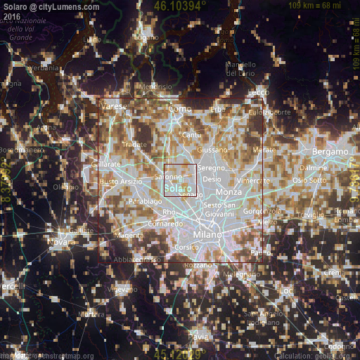
Analysis of Solaro night lights 2016
Square area 10x10 km:
 45.15%
90-99
30.15%80-89
12.88%70-79
10.91%60-69
0.91%50-59
0%40-49
0%30-39
0%20-29
0%10-19
0%0-9
0%Square area 50x50 km:
29.77%90-99
20.52%80-89
7.63%70-79
8.92%60-69
9.76%50-59
6.62%40-49
5.94%30-39
5.87%20-29
3.45%10-19
1.52%0-9
0.01%Clear (daylight) street map image can be seen on geolist.org.
Map coordinates:
46° 6' 14.2" North, 8° 22' 47.7" East
45° 36' 51.4" North, 9° 4' 58.9" East
45° 7' 13" North, 9° 47' 10.2" East
Some cities around Solaro sort by population:
• Saronno
3.9 km =2.4 mi,  287°
287°
• Limbiate
3.7 km =2.3 mi,  116°
116°
• Garbagnate Milanese
4.5 km =2.8 mi,  187°
187°
• Caronno Pertusella
3.4 km =2.1 mi,  237°
237°
• Cesate
2.1 km =1.3 mi,  195°
195°
• Cogliate
3.5 km =2.2 mi,  354°
354°
• Rovello Porro
5.4 km =3.4 mi,  321°
321°
• Ceriano Laghetto
1.7 km =1.1 mi, 352°
3166448 (p: 12,105)
Sources (retrieved 2019-11-25):
» Earth at Night: Flat Maps 2012, 2016