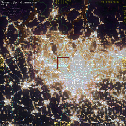
Saronno night lights from space
Night Light of Saronno (Lombardy) from space (Italy) Src. Average luminocity for 10x10km area is 90.3545% and for 50x50km: 76.5354%.

Analysis of Saronno night lights 2016
Square area 10x10 km:
 32.73%
90-99
30.3%80-89
15.45%70-79
12.58%60-69
8.33%50-59
0.61%40-49
0%30-39
0%20-29
0%10-19
0%0-9
0%Square area 50x50 km:
28.75%90-99
19.65%80-89
7.35%70-79
8.71%60-69
9.58%50-59
6.52%40-49
5.83%30-39
5.62%20-29
5.93%10-19
2.02%0-9
0.04%Clear (daylight) street map image can be seen on geolist.org.
Map coordinates:
46° 6' 52.9" North, 8° 19' 55.3" East
45° 37' 30.5" North, 9° 2' 6.6" East
45° 7' 52.5" North, 9° 44' 17.8" East
Some cities around Saronno sort by population:
• Caronno Pertusella
3.2 km =2 mi,  164°
164°
• Solaro
3.9 km =2.4 mi,  107°
107°
• Gerenzano
3.1 km =1.9 mi,  301°
301°
• Uboldo
2.7 km =1.7 mi,  245°
245°
• Cogliate
4.1 km =2.5 mi,  55°
55°
• Origgio
3.5 km =2.2 mi,  204°
204°
• Rovello Porro
3 km =1.9 mi,  6°
6°
• Ceriano Laghetto
3.5 km =2.2 mi,  82°
82°
3167113 (p: 38,099)
Sources (retrieved 2019-11-25):
» Earth at Night: Flat Maps 2012, 2016