San Vito dei Normanni night lights from space
Night Light of San Vito dei Normanni (Apulia) from space (Italy) Src. Average luminocity for 10x10km area is 22.5032% and for 50x50km: 15.8535%.
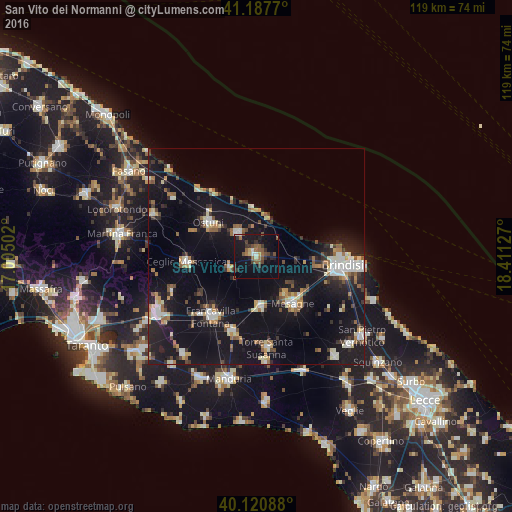
Analysis of San Vito dei Normanni night lights 2016
Square area 10x10 km:
 1.46%
1.46%90-99
1.3%80-89
2.11%70-79
0.49%60-69
3.73%50-59
6.98%40-49
4.22%30-39
6.17%20-29
3.9%10-19
29.87%0-9
39.77%Square area 50x50 km:
1.85%90-99
2.23%80-89
1.6%70-79
1.43%60-69
2.05%50-59
1.75%40-49
1.5%30-39
2.2%20-29
3.86%10-19
22.26%0-9
59.27%Clear (daylight) street map image can be seen on geolist.org.
Map coordinates:
41° 11' 15.7" North, 17° 0' 18.1" East
40° 39' 23.1" North, 17° 42' 29.3" East
40° 7' 15.2" North, 18° 24' 40.6" East
Some cities around San Vito dei Normanni sort by population:
• Francavilla Fontana
17.4 km =10.8 mi,  216°
216°
• Mesagne
13.8 km =8.6 mi,  142°
142°
• Ostuni
13.7 km =8.5 mi,  306°
306°
• Ceglie Messapica
16.2 km =10.1 mi,  265°
265°
• Oria
18.2 km =11.3 mi,  197°
197°
• Latiano
11.8 km =7.3 mi,  175°
175°
• Carovigno
6.9 km =4.3 mi,  322°
322°
• San Michele Salentino
6.9 km =4.3 mi,  246°
246°
3167184 (p: 17,617)
Sources (retrieved 2019-11-25):
» Earth at Night: Flat Maps 2012, 2016