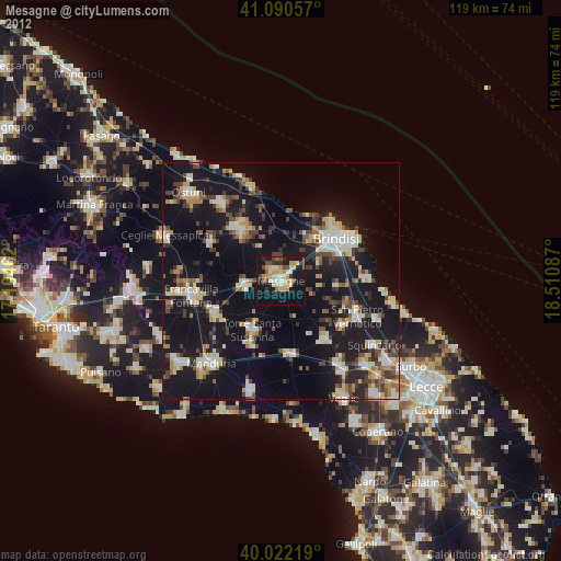
Mesagne night lights from space
Night Light of Mesagne (Apulia) from space (Italy) Src. Average luminocity for 10x10km area is 29.8945% and for 50x50km: 19.295%.
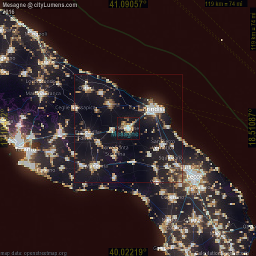
Analysis of Mesagne night lights 2016
Square area 10x10 km:
 2.92%
2.92%90-99
3.25%80-89
3.25%70-79
5.84%60-69
4.87%50-59
4.55%40-49
4.06%30-39
3.57%20-29
2.11%10-19
48.86%0-9
16.72%Square area 50x50 km:
2.37%90-99
2.8%80-89
2.09%70-79
1.5%60-69
2.41%50-59
2.22%40-49
2.03%30-39
2.81%20-29
4.75%10-19
27.49%0-9
49.53%Clear (daylight) street map image can be seen on geolist.org.
Map coordinates:
41° 5' 26.1" North, 17° 6' 16.6" East
40° 33' 30.6" North, 17° 48' 27.9" East
40° 1' 19.9" North, 18° 30' 39.1" East
Some cities around Mesagne sort by population:
• Brindisi
13.6 km =8.5 mi,  52°
52°
• San Vito dei Normanni
13.8 km =8.6 mi,  322°
322°
• Oria
15.4 km =9.6 mi,  244°
244°
• Latiano
7.6 km =4.7 mi,  263°
263°
• San Pancrazio Salentino
15.8 km =9.8 mi,  171°
171°
• Torre Santa Susanna
11.7 km =7.3 mi,  210°
210°
• Erchie
14.9 km =9.3 mi,  203°
203°
• San Donaci
15.6 km =9.7 mi,  141°
141°
3173537 (p: 26,497)
Sources (retrieved 2019-11-25):
» Earth at Night: Flat Maps 2012, 2016