Francavilla Fontana night lights from space
Night Light of Francavilla Fontana (Apulia) from space (Italy) Src. Average luminocity for 10x10km area is 30.3895% and for 50x50km: 20.0253%.
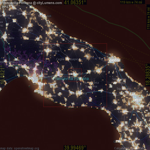
Analysis of Francavilla Fontana night lights 2016
Square area 10x10 km:
 5.27%
5.27%90-99
5.27%80-89
2.38%70-79
2.38%60-69
5.78%50-59
2.89%40-49
1.36%30-39
2.89%20-29
6.46%10-19
48.98%0-9
16.33%Square area 50x50 km:
1.76%90-99
2.57%80-89
2.37%70-79
1.98%60-69
2.78%50-59
2.53%40-49
2.37%30-39
2.41%20-29
6%10-19
27.49%0-9
47.74%Clear (daylight) street map image can be seen on geolist.org.
Map coordinates:
41° 3' 48.6" North, 16° 52' 55.6" East
40° 31' 52.4" North, 17° 35' 6.8" East
39° 59' 40.9" North, 18° 17' 18.1" East
Some cities around Francavilla Fontana sort by population:
• Grottaglie
12.5 km =7.8 mi,  272°
272°
• Ceglie Messapica
14 km =8.7 mi,  335°
335°
• Sava
14.6 km =9.1 mi,  190°
190°
• Oria
6 km =3.7 mi,  125°
125°
• Latiano
11.5 km =7.1 mi,  79°
79°
• San Marzano di San Giuseppe
11 km =6.8 mi,  219°
219°
• Villa Castelli
11 km =6.8 mi,  301°
301°
• San Michele Salentino
11.9 km =7.4 mi,  19°
19°
3176603 (p: 33,415)
Sources (retrieved 2019-11-25):
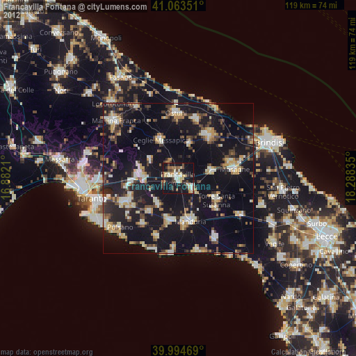
» Earth at Night: Flat Maps 2012, 2016