San Benedetto Po night lights from space
Night Light of San Benedetto Po (Lombardy) from space (Italy) Src. Average luminocity for 10x10km area is 17.3515% and for 50x50km: 27.5295%.
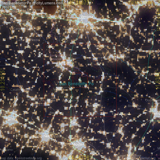
Analysis of San Benedetto Po night lights 2016
Square area 10x10 km:
 0.76%
0.76%90-99
2.88%80-89
3.18%70-79
1.36%60-69
0.61%50-59
3.18%40-49
2.42%30-39
1.06%20-29
1.06%10-19
9.39%0-9
74.09%Square area 50x50 km:
3.19%90-99
5.23%80-89
2.66%70-79
2.19%60-69
2.41%50-59
3.18%40-49
3.56%30-39
3.82%20-29
10.74%10-19
38.04%0-9
24.98%Clear (daylight) street map image can be seen on geolist.org.
Map coordinates:
45° 32' 26.7" North, 10° 13' 50" East
45° 2' 46" North, 10° 56' 1.2" East
44° 32' 49.8" North, 11° 38' 12.5" East
Some cities around San Benedetto Po sort by population:
• Mantova
16.6 km =10.3 mi,  319°
319°
• Suzzara
16.1 km =10 mi,  248°
248°
• Mottella
14.8 km =9.2 mi,  331°
331°
• Cerese
13.9 km =8.6 mi,  305°
305°
• Reggiolo
17.2 km =10.7 mi,  214°
214°
• Poggio Rusco
16 km =9.9 mi,  123°
123°
• Ostiglia
16 km =9.9 mi,  80°
80°
• Gonzaga
13.8 km =8.6 mi,  220°
220°
3168546 (p: 5,312)
Sources (retrieved 2019-11-25):
» Earth at Night: Flat Maps 2012, 2016