Reggiolo night lights from space
Night Light of Reggiolo (Emilia-Romagna) from space (Italy) Src. Average luminocity for 10x10km area is 35.0508% and for 50x50km: 30.1625%.
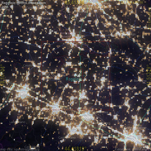
Analysis of Reggiolo night lights 2016
Square area 10x10 km:
 5.08%
5.08%90-99
8.57%80-89
3.33%70-79
2.38%60-69
2.22%50-59
1.75%40-49
3.33%30-39
3.02%20-29
22.7%10-19
46.98%0-9
0.63%Square area 50x50 km:
3.87%90-99
5.65%80-89
2.65%70-79
2.34%60-69
2.8%50-59
3.36%40-49
4.35%30-39
4.97%20-29
13.17%10-19
37.41%0-9
19.43%Clear (daylight) street map image can be seen on geolist.org.
Map coordinates:
45° 24' 50.3" North, 10° 6' 25.3" East
44° 55' 5.7" North, 10° 48' 36.6" East
44° 25' 5.5" North, 11° 30' 47.8" East
Some cities around Reggiolo sort by population:
• Carpi Centro
16 km =9.9 mi,  160°
160°
• Suzzara
9.8 km =6.1 mi,  327°
327°
• Guastalla
11.7 km =7.3 mi,  266°
266°
• Novellara
10.4 km =6.5 mi,  218°
218°
• Fabbrico
5.1 km =3.2 mi,  181°
181°
• Novi di Modena
7.8 km =4.8 mi,  114°
114°
• Gonzaga
3.8 km =2.4 mi,  10°
10°
• Rio Saliceto
11.9 km =7.4 mi, 182°
3169523 (p: 6,753)
Sources (retrieved 2019-11-25):
» Earth at Night: Flat Maps 2012, 2016