Gonzaga night lights from space
Night Light of Gonzaga (Lombardy) from space (Italy) Src. Average luminocity for 10x10km area is 37.4143% and for 50x50km: 29.5781%.
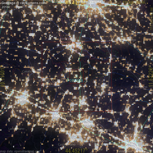
Analysis of Gonzaga night lights 2016
Square area 10x10 km:
 4.92%
4.92%90-99
9.21%80-89
3.02%70-79
3.65%60-69
2.22%50-59
4.29%40-49
4.29%30-39
3.49%20-29
19.21%10-19
45.56%0-9
0.16%Square area 50x50 km:
3.78%90-99
5.79%80-89
2.66%70-79
2.29%60-69
2.66%50-59
3.31%40-49
4.09%30-39
4.51%20-29
11.39%10-19
38.36%0-9
21.16%Clear (daylight) street map image can be seen on geolist.org.
Map coordinates:
45° 26' 50.5" North, 10° 6' 57.6" East
44° 57' 6.9" North, 10° 49' 8.9" East
44° 27' 7.8" North, 11° 31' 20.1" East
Some cities around Gonzaga sort by population:
• Suzzara
7.4 km =4.6 mi,  307°
307°
• Guastalla
13.2 km =8.2 mi,  250°
250°
• Novellara
13.9 km =8.6 mi,  211°
211°
• Reggiolo
3.8 km =2.4 mi,  190°
190°
• Fabbrico
8.9 km =5.5 mi, 185°
• Novi di Modena
9.4 km =5.8 mi,  137°
137°
• San Benedetto Po
13.8 km =8.6 mi,  40°
40°
• Rio Saliceto
15.7 km =9.8 mi,  184°
184°
3176002 (p: 5,230)
Sources (retrieved 2019-11-25):
» Earth at Night: Flat Maps 2012, 2016