Pavullo nel Frignano night lights from space
Night Light of Pavullo nel Frignano (Emilia-Romagna) from space (Italy) Src. Average luminocity for 10x10km area is 7.4746% and for 50x50km: 9.9429%.
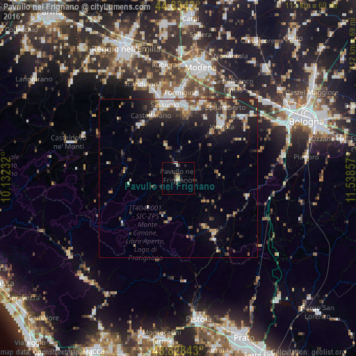
Analysis of Pavullo nel Frignano night lights 2016
Square area 10x10 km:
 0.79%
0.79%90-99
0.79%80-89
1.59%70-79
0.63%60-69
0%50-59
0.79%40-49
1.75%30-39
1.9%20-29
1.75%10-19
0.79%0-9
89.21%Square area 50x50 km:
1.06%90-99
1.69%80-89
1.07%70-79
1.1%60-69
1.14%50-59
1.05%40-49
1.75%30-39
1.84%20-29
4.19%10-19
5.6%0-9
79.51%Clear (daylight) street map image can be seen on geolist.org.
Map coordinates:
44° 50' 3.5" North, 10° 7' 56.4" East
44° 20' 0.7" North, 10° 50' 7.6" East
43° 49' 42.3" North, 11° 32' 18.9" East
Some cities around Pavullo nel Frignano sort by population:
• Sassuolo
23.7 km =14.7 mi,  350°
350°
• Vignola
21.8 km =13.5 mi,  39°
39°
• Fiorano
22.9 km =14.2 mi,  355°
355°
• Castellarano
22 km =13.7 mi,  339°
339°
• Maranello
22.1 km =13.7 mi,  6°
6°
• Spilamberto
26.4 km =16.4 mi,  33°
33°
• Castelnuovo Rangone
25.2 km =15.7 mi,  17°
17°
• Veggia-Villalunga
26 km =16.2 mi, 346°
3171355 (p: 9,063)
Sources (retrieved 2019-11-25):
» Earth at Night: Flat Maps 2012, 2016