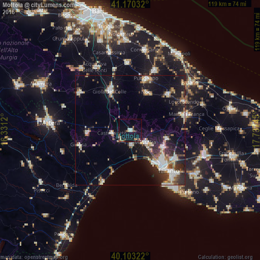
Mottola night lights from space
Night Light of Mottola (Apulia) from space (Italy) Src. Average luminocity for 10x10km area is 16.9935% and for 50x50km: 16.1637%.
Analysis of Mottola night lights 2016
Square area 10x10 km:
 1.95%
1.95%90-99
1.95%80-89
1.46%70-79
1.95%60-69
2.44%50-59
1.95%40-49
1.46%30-39
0.81%20-29
3.41%10-19
30.68%0-9
51.95%Square area 50x50 km:
2.5%90-99
3%80-89
1.5%70-79
1.18%60-69
1.84%50-59
1.94%40-49
1.83%30-39
2.62%20-29
5.13%10-19
12.37%0-9
66.09%Clear (daylight) street map image can be seen on geolist.org.
Map coordinates:
41° 10' 13.2" North, 16° 19' 52.3" East
40° 38' 20" North, 17° 2' 3.6" East
40° 6' 11.6" North, 17° 44' 14.8" East
Some cities around Mottola sort by population:
• Massafra
9.1 km =5.7 mi,  130°
130°
• Palagiano
6.8 km =4.2 mi,  177°
177°
• Noci
18.9 km =11.7 mi,  24°
24°
• Castellaneta
8.6 km =5.3 mi,  261°
261°
• Laterza
19.8 km =12.3 mi,  266°
266°
• Statte
18.7 km =11.6 mi, 131°
• Crispiano
17.2 km =10.7 mi,  103°
103°
• Palagianello
5.8 km =3.6 mi,  234°
234°
3172499 (p: 13,146)
Sources (retrieved 2019-11-25):
» Earth at Night: Flat Maps 2012, 2016