Statte night lights from space
Night Light of Statte (Apulia) from space (Italy) Src. Average luminocity for 10x10km area is 64.7041% and for 50x50km: 18.3638%.
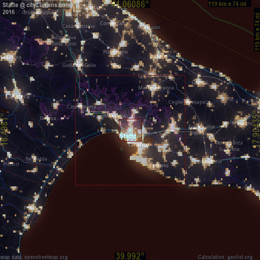
Analysis of Statte night lights 2016
Square area 10x10 km:
 18.2%
18.2%90-99
18.54%80-89
2.89%70-79
5.1%60-69
7.65%50-59
10.2%40-49
6.12%30-39
15.31%20-29
15.99%10-19
0%0-9
0%Square area 50x50 km:
2.54%90-99
3.33%80-89
1.95%70-79
1.51%60-69
2.2%50-59
2.2%40-49
2.24%30-39
2.69%20-29
7.2%10-19
16.56%0-9
57.58%Clear (daylight) street map image can be seen on geolist.org.
Map coordinates:
41° 3' 39.1" North, 16° 29' 53.2" East
40° 31' 42.8" North, 17° 12' 4.4" East
39° 59' 31.2" North, 17° 54' 15.7" East
Some cities around Statte sort by population:
• Taranto
8.1 km =5 mi,  151°
151°
• Massafra
9.6 km =6 mi,  311°
311°
• Paolo VI
6.2 km =3.9 mi,  96°
96°
• Palagiano
14.8 km =9.2 mi,  291°
291°
• San Giorgio Ionico
17.1 km =10.6 mi,  117°
117°
• Crispiano
8.8 km =5.5 mi,  17°
17°
• Carosino
18.1 km =11.2 mi,  112°
112°
• Monteiasi
15.7 km =9.8 mi, 101°
3166189 (p: 13,867)
Sources (retrieved 2019-11-25):
» Earth at Night: Flat Maps 2012, 2016