Laterza night lights from space
Night Light of Laterza (Apulia) from space (Italy) Src. Average luminocity for 10x10km area is 12.836% and for 50x50km: 9.9407%.
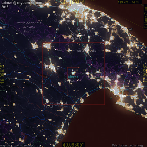
Analysis of Laterza night lights 2016
Square area 10x10 km:
 1.14%
1.14%90-99
3.08%80-89
0.32%70-79
0%60-69
2.6%50-59
2.76%40-49
0.49%30-39
0.65%20-29
2.76%10-19
4.71%0-9
81.49%Square area 50x50 km:
1.36%90-99
1.83%80-89
1.03%70-79
0.8%60-69
0.96%50-59
0.89%40-49
0.98%30-39
1.16%20-29
2.07%10-19
8.12%0-9
80.81%Clear (daylight) street map image can be seen on geolist.org.
Map coordinates:
41° 9' 37.1" North, 16° 5' 46.9" East
40° 37' 43.7" North, 16° 47' 58.1" East
40° 5' 35" North, 17° 30' 9.4" East
Some cities around Laterza sort by population:
• Matera
16.9 km =10.5 mi,  284°
284°
• Santeramo in Colle
18.5 km =11.5 mi,  349°
349°
• Ginosa
6.8 km =4.2 mi,  212°
212°
• Palagiano
20.9 km =13 mi,  105°
105°
• Castellaneta
11.3 km =7 mi,  90°
90°
• Mottola
19.8 km =12.3 mi, 86°
• Montescaglioso
14.3 km =8.9 mi,  232°
232°
• Palagianello
15.2 km =9.4 mi,  98°
98°
3175064 (p: 13,879)
Sources (retrieved 2019-11-25):
» Earth at Night: Flat Maps 2012, 2016