Palagianello night lights from space
Night Light of Palagianello (Apulia) from space (Italy) Src. Average luminocity for 10x10km area is 22.0276% and for 50x50km: 13.5543%.
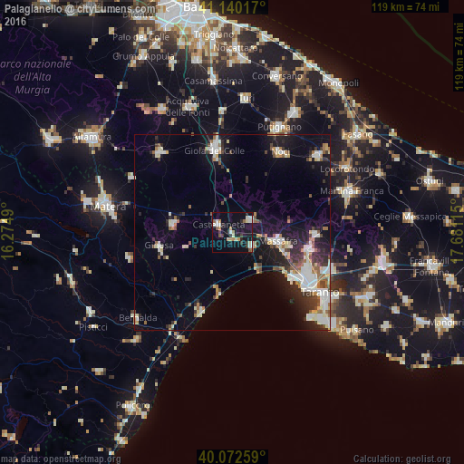
Analysis of Palagianello night lights 2016
Square area 10x10 km:
 3.41%
3.41%90-99
3.08%80-89
2.76%70-79
2.92%60-69
1.46%50-59
2.27%40-49
1.46%30-39
3.41%20-29
4.55%10-19
22.08%0-9
52.6%Square area 50x50 km:
2.32%90-99
2.75%80-89
1.26%70-79
1.03%60-69
1.44%50-59
1.45%40-49
1.33%30-39
2.09%20-29
3.51%10-19
8.8%0-9
74.03%Clear (daylight) street map image can be seen on geolist.org.
Map coordinates:
41° 8' 24.6" North, 16° 16' 29.6" East
40° 36' 30.6" North, 16° 58' 40.9" East
40° 4' 21.3" North, 17° 40' 52.1" East
Some cities around Palagianello sort by population:
• Massafra
11.9 km =7.4 mi,  102°
102°
• Gioia del Colle
21.8 km =13.5 mi,  347°
347°
• Ginosa
19 km =11.8 mi,  259°
259°
• Castellaneta
4.4 km =2.7 mi,  299°
299°
• Laterza
15.2 km =9.4 mi,  278°
278°
• Statte
20.8 km =12.9 mi,  115°
115°
• Mottola
5.8 km =3.6 mi,  54°
54°
• Crispiano
21.5 km =13.4 mi,  91°
91°
3171665 (p: 7,195)
Sources (retrieved 2019-11-25):
» Earth at Night: Flat Maps 2012, 2016