Montebelluna night lights from space
Night Light of Montebelluna (Veneto) from space (Italy) Src. Average luminocity for 10x10km area is 44.0508% and for 50x50km: 40.1253%.
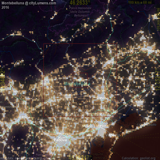
Analysis of Montebelluna night lights 2016
Square area 10x10 km:
 3.65%
3.65%90-99
6.98%80-89
7.62%70-79
4.44%60-69
5.24%50-59
8.25%40-49
8.1%30-39
6.35%20-29
35.71%10-19
13.49%0-9
0.16%Square area 50x50 km:
3.87%90-99
6.12%80-89
4.16%70-79
4.63%60-69
7.19%50-59
9.32%40-49
10.09%30-39
9.69%20-29
14.95%10-19
13.05%0-9
16.93%Clear (daylight) street map image can be seen on geolist.org.
Map coordinates:
46° 15' 47.9" North, 11° 20' 45.3" East
45° 46' 30.1" North, 12° 2' 56.5" East
45° 16' 56.9" North, 12° 45' 7.8" East
Some cities around Montebelluna sort by population:
• Castelfranco Veneto
14.9 km =9.3 mi,  219°
219°
• Ponzano
13.8 km =8.6 mi,  118°
118°
• Paese
14.3 km =8.9 mi,  141°
141°
• Col San Martino
14.8 km =9.2 mi,  20°
20°
• Caerano di San Marco
4 km =2.5 mi,  280°
280°
• Valdobbiadene
14.5 km =9 mi,  339°
339°
• Crocetta del Montello
7 km =4.3 mi,  350°
350°
• Cornuda
7.1 km =4.4 mi,  332°
332°
3173029 (p: 26,670)
Sources (retrieved 2019-11-25):
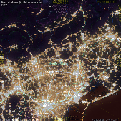
» Earth at Night: Flat Maps 2012, 2016