Meldola night lights from space
Night Light of Meldola (Emilia-Romagna) from space (Italy) Src. Average luminocity for 10x10km area is 13.9288% and for 50x50km: 15.9888%.
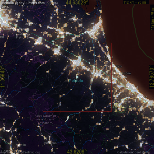
Analysis of Meldola night lights 2016
Square area 10x10 km:
 0.91%
0.91%90-99
0.3%80-89
1.82%70-79
0.61%60-69
0%50-59
1.67%40-49
3.48%30-39
1.97%20-29
10.45%10-19
21.82%0-9
56.97%Square area 50x50 km:
2.43%90-99
2.67%80-89
1.06%70-79
1.48%60-69
1.48%50-59
1.95%40-49
2.75%30-39
2.96%20-29
6.46%10-19
13.77%0-9
63%Clear (daylight) street map image can be seen on geolist.org.
Map coordinates:
44° 37' 49" North, 11° 21' 34.1" East
44° 7' 39.9" North, 12° 3' 45.4" East
43° 37' 15.2" North, 12° 45' 56.6" East
Some cities around Meldola sort by population:
• Forlì
10.6 km =6.6 mi,  350°
350°
• Cesena
14.5 km =9 mi,  84°
84°
• Faenza
23.2 km =14.4 mi,  321°
321°
• Cervia
27.2 km =16.9 mi,  56°
56°
• Gambettola
21.9 km =13.6 mi,  92°
92°
• Forlimpopoli
8.8 km =5.5 mi,  36°
36°
• Gatteo-Sant'Angelo
26.3 km =16.3 mi, 93°
• Castrocaro Terme e Terra del Sole
10.4 km =6.5 mi,  308°
308°
3173635 (p: 7,011)
Sources (retrieved 2019-11-25):
» Earth at Night: Flat Maps 2012, 2016