Forlì night lights from space
Night Light of Forlì (Emilia-Romagna) from space (Italy) Src. Average luminocity for 10x10km area is 56.1591% and for 50x50km: 22.0283%.
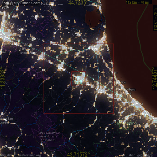

Analysis of Forlì night lights 2016
Square area 10x10 km:
 14.7%
14.7%90-99
17.27%80-89
3.94%70-79
1.52%60-69
8.03%50-59
4.55%40-49
6.52%30-39
9.7%20-29
15.45%10-19
17.12%0-9
1.21%Square area 50x50 km:
3.67%90-99
3.98%80-89
1.6%70-79
1.72%60-69
2.18%50-59
2.75%40-49
3.16%30-39
3.49%20-29
9.02%10-19
21.81%0-9
46.6%Clear (daylight) street map image can be seen on geolist.org.
Map coordinates:
44° 43' 24.6" North, 11° 20' 18" East
44° 13' 18.4" North, 12° 2' 29.2" East
43° 42' 56.6" North, 12° 44' 40.5" East
Some cities around Forlì sort by population:
• Cesena
18.5 km =11.5 mi,  119°
119°
• Faenza
15 km =9.3 mi,  300°
300°
• Lugo
24.5 km =15.2 mi,  334°
334°
• Bagnacavallo
22 km =13.7 mi,  346°
346°
• Castel Bolognese
22.2 km =13.8 mi, 299°
• Meldola
10.6 km =6.6 mi,  170°
170°
• Russi
17.2 km =10.7 mi,  357°
357°
• Castrocaro Terme e Terra del Sole
7.5 km =4.7 mi,  238°
238°
3176746 (p: 93,638)
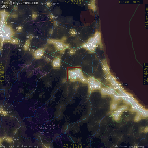
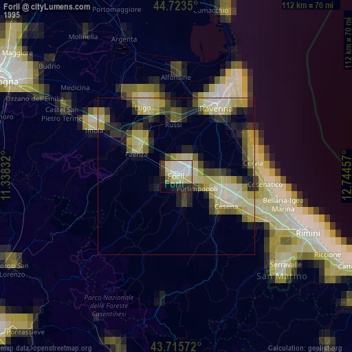
Sources (retrieved 2019-11-25):
» NASA, Earths city lights 1995
» NASA city lights 2003
» Earth at Night: Flat Maps 2012, 2016