Cervia night lights from space
Night Light of Cervia (Emilia-Romagna) from space (Italy) Src. Average luminocity for 10x10km area is 30.4348% and for 50x50km: 23.2483%.
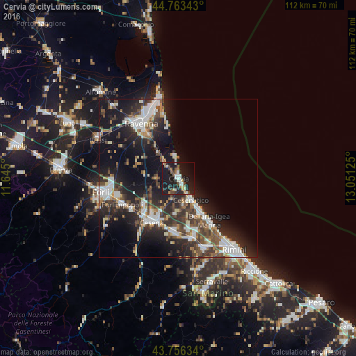
Analysis of Cervia night lights 2016
Square area 10x10 km:
 4.85%
4.85%90-99
4.24%80-89
2.42%70-79
3.03%60-69
3.79%50-59
3.18%40-49
4.7%30-39
2.12%20-29
11.52%10-19
47.88%0-9
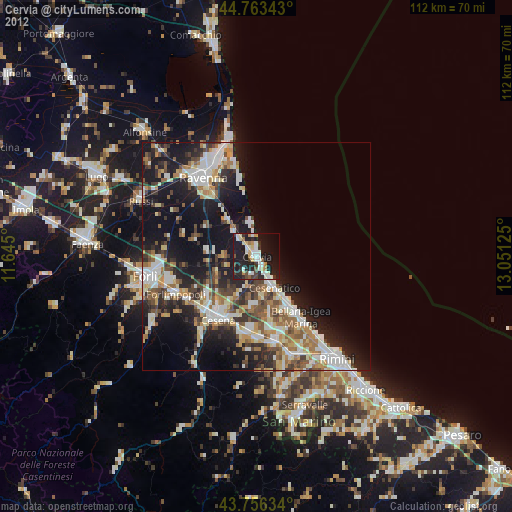
12.27%Square area 50x50 km:
4.44%90-99
4.73%80-89
1.52%70-79
1.73%60-69
2.35%50-59
3.07%40-49
3.98%30-39
4.12%20-29
8.78%10-19
16.59%0-9
48.7%Clear (daylight) street map image can be seen on geolist.org.
Map coordinates:
44° 45' 48.3" North, 11° 38' 42" East
44° 15' 43.3" North, 12° 20' 53.2" East
43° 45' 22.8" North, 13° 3' 4.5" East
Some cities around Cervia sort by population:
• Cesena
16 km =9.9 mi,  211°
211°
• Cesenatico
8 km =5 mi,  149°
149°
• Bellaria-Igea Marina
16.5 km =10.3 mi,  143°
143°
• Gambettola
16.1 km =10 mi,  183°
183°
• Forlimpopoli
19.2 km =11.9 mi,  245°
245°
• San Mauro Pascoli
18 km =11.2 mi,  161°
161°
• Lido Adriano
17.5 km =10.9 mi,  348°
348°
• Gatteo-Sant'Angelo
17 km =10.6 mi,  168°
168°
3178998 (p: 20,487)
Sources (retrieved 2019-11-25):
» Earth at Night: Flat Maps 2012, 2016