Cesena night lights from space
Night Light of Cesena (Emilia-Romagna) from space (Italy) Src. Average luminocity for 10x10km area is 57.3864% and for 50x50km: 22.8027%.
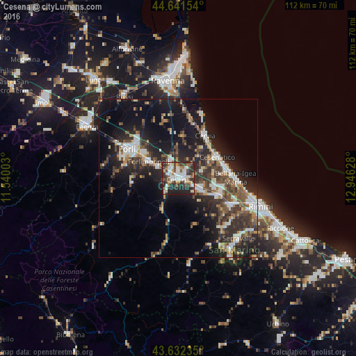
Analysis of Cesena night lights 2016
Square area 10x10 km:
 14.7%
14.7%90-99
13.79%80-89
4.24%70-79
5.76%60-69
5.91%50-59
5.15%40-49
10.3%30-39
10.91%20-29
21.67%10-19
7.58%0-9
0%Square area 50x50 km:
3.43%90-99
4.12%80-89
1.7%70-79
1.83%60-69
2.51%50-59
3.31%40-49
4.22%30-39
4.81%20-29
9.28%10-19
15.52%0-9
49.27%Clear (daylight) street map image can be seen on geolist.org.
Map coordinates:
44° 38' 29.5" North, 11° 32' 24.1" East
44° 8' 20.8" North, 12° 14' 35.3" East
43° 37' 56.5" North, 12° 56' 46.6" East
Some cities around Cesena sort by population:
• Cervia
16 km =9.9 mi,  31°
31°
• Bellaria-Igea Marina
18.2 km =11.3 mi,  88°
88°
• Savignano sul Rubicone
13.6 km =8.5 mi,  113°
113°
• Gambettola
7.9 km =4.9 mi, 107°
• Forlimpopoli
10.8 km =6.7 mi,  302°
302°
• San Mauro Pascoli
14.5 km =9 mi,  103°
103°
• Meldola
14.5 km =9 mi,  264°
264°
• Gatteo-Sant'Angelo
12.2 km =7.6 mi, 104°
3178957 (p: 79,398)
Sources (retrieved 2019-11-25):
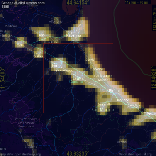
» NASA, Earths city lights 1995
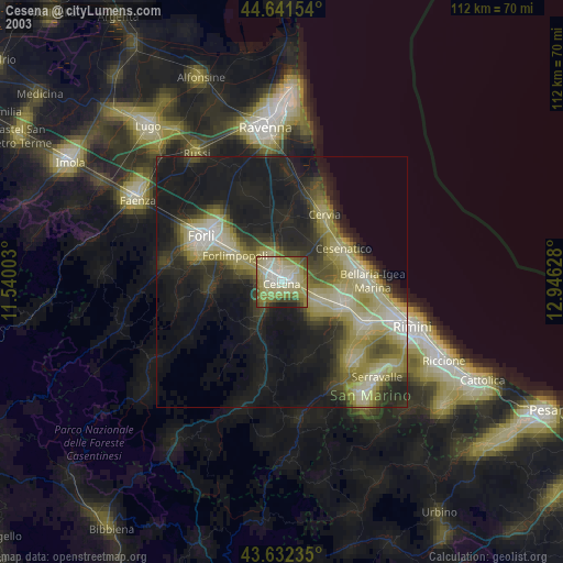
» NASA city lights 2003
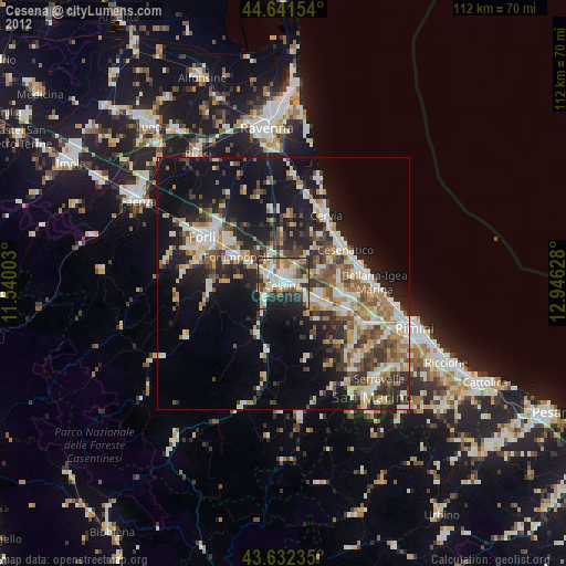
» Earth at Night: Flat Maps 2012, 2016