Forlimpopoli night lights from space
Night Light of Forlimpopoli (Emilia-Romagna) from space (Italy) Src. Average luminocity for 10x10km area is 43.9197% and for 50x50km: 21.9312%.
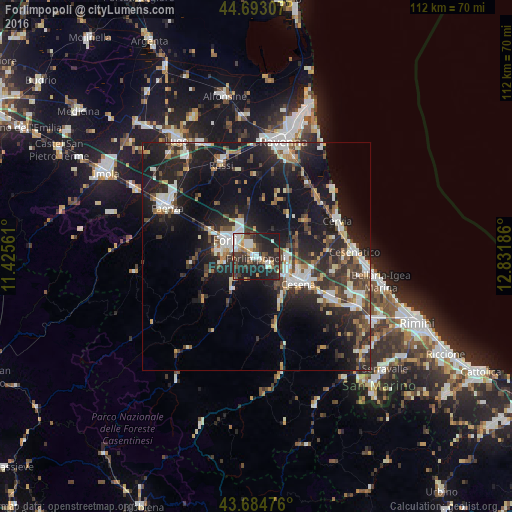
Analysis of Forlimpopoli night lights 2016
Square area 10x10 km:
 8.79%
8.79%90-99
8.03%80-89
2.42%70-79
4.85%60-69
4.09%50-59
4.39%40-49
6.67%30-39
11.82%20-29
25.3%10-19
23.64%0-9
0%Square area 50x50 km:
3.36%90-99
3.91%80-89
1.57%70-79
1.87%60-69
2.24%50-59
2.65%40-49
3.73%30-39
4.07%20-29
9.5%10-19
19.14%0-9
47.96%Clear (daylight) street map image can be seen on geolist.org.
Map coordinates:
44° 41' 35.1" North, 11° 25' 32.2" East
44° 11' 27.9" North, 12° 7' 43.4" East
43° 41' 5.1" North, 12° 49' 54.7" East
Some cities around Forlimpopoli sort by population:
• Cesena
10.8 km =6.7 mi,  122°
122°
• Cervia
19.2 km =11.9 mi,  65°
65°
• Cesenatico
21.6 km =13.4 mi,  87°
87°
• Gambettola
18.5 km =11.5 mi, 116°
• Meldola
8.8 km =5.5 mi,  216°
216°
• Russi
22 km =13.7 mi,  339°
339°
• Gatteo-Sant'Angelo
22.7 km =14.1 mi,  112°
112°
• Castrocaro Terme e Terra del Sole
13.4 km =8.3 mi,  267°
267°
3176743 (p: 9,392)
Sources (retrieved 2019-11-25):
» Earth at Night: Flat Maps 2012, 2016