Marotta night lights from space
Night Light of Marotta (The Marches) from space (Italy) Src. Average luminocity for 10x10km area is 25.8182% and for 50x50km: 12.7783%.
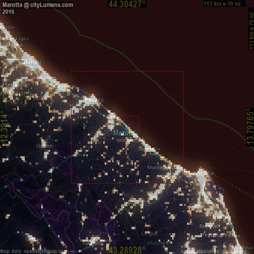
Analysis of Marotta night lights 2016
Square area 10x10 km:
 3.18%
3.18%90-99
4.85%80-89
1.97%70-79
1.97%60-69
4.24%50-59
3.33%40-49
1.67%30-39
3.18%20-29
4.24%10-19
44.24%0-9
27.12%Square area 50x50 km:
1.6%90-99
2.38%80-89
1.06%70-79
1.13%60-69
1.45%50-59
1.16%40-49
1.46%30-39
1.59%20-29
4.64%10-19
14.31%0-9
69.24%Clear (daylight) street map image can be seen on geolist.org.
Map coordinates:
44° 18' 15.4" North, 12° 23' 29" East
43° 47' 56.1" North, 13° 5' 40.3" East
43° 17' 21.4" North, 13° 47' 51.5" East
Some cities around Marotta sort by population:
• Pesaro
18.8 km =11.7 mi,  310°
310°
• Fano
7.8 km =4.8 mi, 306°
• Senigallia
13 km =8.1 mi,  135°
135°
• Falconara Marittima
31.2 km =19.4 mi,  128°
128°
• Chiaravalle
28.8 km =17.9 mi, 139°
• Fossombrone
25.7 km =16 mi,  241°
241°
• Lucrezia
12.7 km =7.9 mi,  256°
256°
• Calcinelli
14.9 km =9.3 mi,  250°
250°
9036385 (p: 6,060)
Sources (retrieved 2019-11-25):
» Earth at Night: Flat Maps 2012, 2016