Itri night lights from space
Night Light of Itri (Latium) from space (Italy) Src. Average luminocity for 10x10km area is 10.8912% and for 50x50km: 11.0739%.
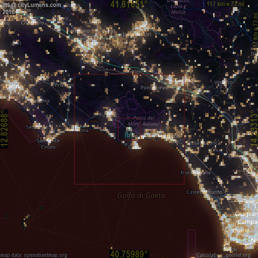
Analysis of Itri night lights 2016
Square area 10x10 km:
 0.65%
0.65%90-99
1.3%80-89
0%70-79
0%60-69
1.62%50-59
2.11%40-49
2.6%30-39
1.79%20-29
2.76%10-19
15.75%0-9
71.43%Square area 50x50 km:
0.79%90-99
1.89%80-89
0.93%70-79
1.12%60-69
1.25%50-59
2.13%40-49
1.69%30-39
1.68%20-29
2.69%10-19
11.89%0-9
73.93%Clear (daylight) street map image can be seen on geolist.org.
Map coordinates:
41° 48' 59.4" North, 12° 49' 36.8" East
41° 17' 25.2" North, 13° 31' 48" East
40° 45' 35.6" North, 14° 13' 59.3" East
Some cities around Itri sort by population:
• Terracina
23.9 km =14.9 mi,  270°
270°
• Formia
7.6 km =4.7 mi,  119°
119°
• Fondi
11.4 km =7.1 mi,  311°
311°
• Gaeta
9.1 km =5.7 mi,  158°
158°
• Minturno
18.3 km =11.4 mi,  99°
99°
• Pontecorvo
21.9 km =13.6 mi,  31°
31°
• Cellole
28.7 km =17.8 mi,  109°
109°
• Ceprano
28.4 km =17.6 mi,  357°
357°
3175392 (p: 8,360)
Sources (retrieved 2019-11-25):
» Earth at Night: Flat Maps 2012, 2016