Cellole night lights from space
Night Light of Cellole (Campania) from space (Italy) Src. Average luminocity for 10x10km area is 28.4237% and for 50x50km: 16.7562%.
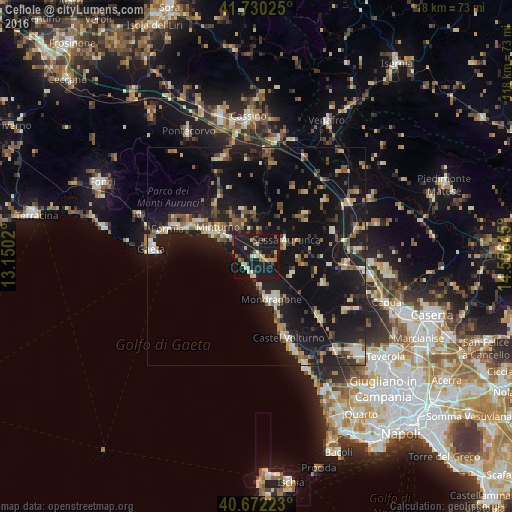
Analysis of Cellole night lights 2016
Square area 10x10 km:
 0.32%
0.32%90-99
5.03%80-89
4.71%70-79
4.38%60-69
1.14%50-59
4.71%40-49
2.92%30-39
2.27%20-29
5.84%10-19
62.66%0-9
6.01%Square area 50x50 km:
0.96%90-99
2.67%80-89
1.76%70-79
1.62%60-69
1.94%50-59
2.71%40-49
2.21%30-39
2.12%20-29
4.33%10-19
25.31%0-9
54.39%Clear (daylight) street map image can be seen on geolist.org.
Map coordinates:
41° 43' 48.9" North, 13° 9' 0.7" East
41° 12' 12.2" North, 13° 51' 12" East
40° 40' 20" North, 14° 33' 23.2" East
Some cities around Cellole sort by population:
• Formia
21.3 km =13.2 mi,  286°
286°
• Mondragone
10.4 km =6.5 mi,  162°
162°
• Castel Volturno
20.4 km =12.7 mi, 158°
• Minturno
11.2 km =7 mi,  306°
306°
• Sparanise
20.4 km =12.7 mi,  94°
94°
• Calvi Risorta
23.3 km =14.5 mi, 86°
• Sessa Aurunca
7.6 km =4.7 mi,  57°
57°
• Teano
18.6 km =11.6 mi,  73°
73°
3179188 (p: 5,765)
Sources (retrieved 2019-11-25):
» Earth at Night: Flat Maps 2012, 2016